High Falls, the Water Slide and the Barron Canyon
Some Trip-Planning Notes
We get a lot of enquiries about visiting High Falls, the Water Slide and the Barron Canyon. This page is an attempt to provide some of the information most often requested. It is not a comprehensive guide to trip planning, but rather an attempt to answer questions that may arise as you plan your trip.
Coverage includes Achray, Barron Canyon, Barron River, Ooze Lake, High Falls, High Falls Lake, Opalescent Lake, Cascades, St. Andrews Lake, Brigham Lake, Brigham Chute, Cache Rapids, Cork Lake, Marie Lake, and Squirrel Rapids.
There is no unique "right way" to visit High Falls, the Water Slide, or the Barron Canyon. But some ways are better than others. In places the country is very rough with lots of broken rock, and travel is difficult. But that is also why it is picturesque. The earth split apart here!
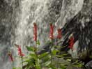
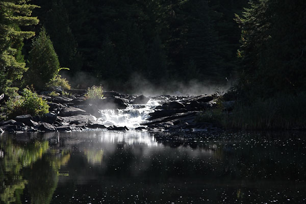
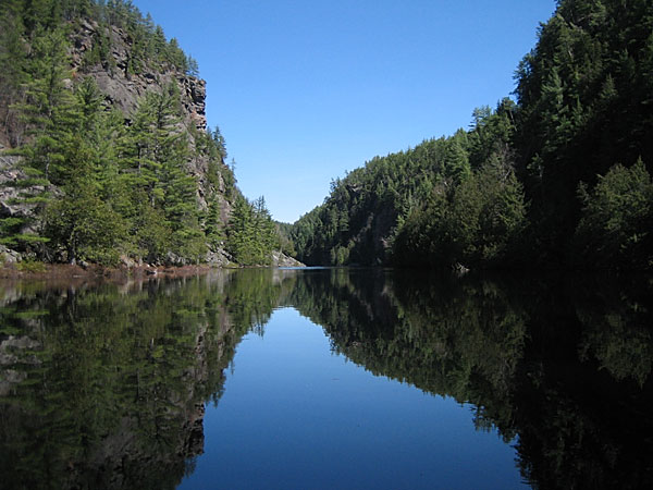
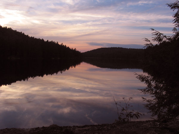
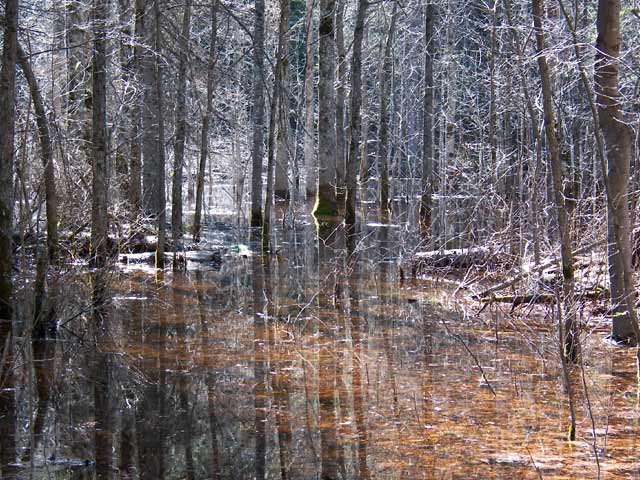
(photo by Bob: 2006-04-27 - map - explore)
The Barron River just upstream of the water slide. (2006 April)
Visiting the Water Slide
The water slide is located on the channel of the Barron River that flows from Stratton Lake into High Falls Lake.
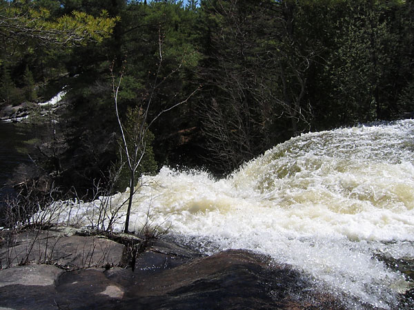
(photo by Bob: 2005-07-15 - map - explore)
The water slide. (2005 July)
There are three reasonable ways to visit the water slide:
via Stratton Lake by canoe
via the Eastern Pines Hiking Trail from Achray
via the High Falls Trail (1) from the Barron Canyon Road.
It is physically possible, but not recommended, to reach the water slide by bushwhacking from High Falls Lake. This might be OK for fit adults with sturdy footwear, but not for children. The ground is very rough with lots of broken rock. Plan your trip to reach the water slide by one of the three alternatives listed above. (For a different opinion however, see the Discussion).
If you are on a canoe trip and you wish to spend time at the water slide, your best bet is to camp on either Stratton Lake or on St. Andrews Lake — St. Andrews Lake is the nicer of the two. If you only wish to view the water slide, take a detour to the bottom of the end bay on Stratton Lake before continuing on your way; don't plan on scrambling back from High Falls Lake.
High Falls Lake
To reach High Falls Lake from Stratton Lake by canoe, you need to go via St. Andrews Lake. There is no direct route from Stratton Lake to High Falls Lake. The intervening country is too rough.
Viewing High Falls
High Falls is located on the channel of the Barron River that flows from Stratton Lake to High Falls Lake, a hundred meters or so downstream from the water slide. High Falls may be viewed from the top by approaching from the water slide, or from the bottom by approaching from High Falls Lake. The existence of the falls is not obvious from the water slide, nor can they be seen from High Falls Lake; the falls are easy to miss if you are not looking for them.
To reach the top of the falls, proceed to the water slide by one of the three recommended approaches. Then follow the river downstream to the top of the falls; either shore will work. We have never actually climbed down from the top of the falls to the bottom, but we know others have. However, without personal experience, we cannot advise how to do so safely.
It is also possible to reach the top of the falls by bushwhacking along the north-western shore from High Falls Lake, but this route is rough and difficult and we don't recommend it.
Looking over the brink of High Falls in the spring. In the background can be seen a third channel of the Barron River that flows from St. Andrews Lake to the pond at the foot of High Falls. That channel usually only flows in the spring. (2006 April)
You can reach the opposite shore of the pond that High Falls falls into by bushwhacking from the portage between St. Andrews and High Falls Lake. It is most straightforward to start at the High Falls Lake end but starting at the St. Andrews Lake end also works. If you start at the High Falls Lake end, there is a maze of paths, all trying to find an easy route through; there is none. When you reach the pond, it is of course possible to continue bushwhacking along the shore of the pond to reach the falls, then climbing the drop to reach the vicinity of the water slide, but as mentioned above, such a route is difficult and not recommended.

(photo by Bob: 2006-05-09 - explore)
High Falls as viewed across the pond at the bottom. This location can be reached by bushwhacking from the portage that runs from St. Andrews Lake to High Falls Lake. In this instance, we started at the High Falls Lake end of the portage. (2006 May)
High Falls Lake to the Barron Canyon
To travel from High Falls Lake to Brigham Lake and then on to the Barron Canyon, there are two possible routes: downstream on the Barron River, or overland through Ooze Lake and Opalescent Lake. There is little to choose between these routes. Total portaging distance is less via the river, but there are more portages.
All of the portages along the river are necessary. The river is obstructed, with no path through, and in some cases there are also small drops.
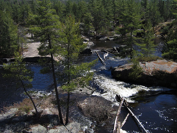
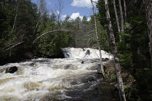
(photo by Bob: 2009-09-16 - explore)
The second portage downriver from High Falls Lake is around this small drop. (2009 September)
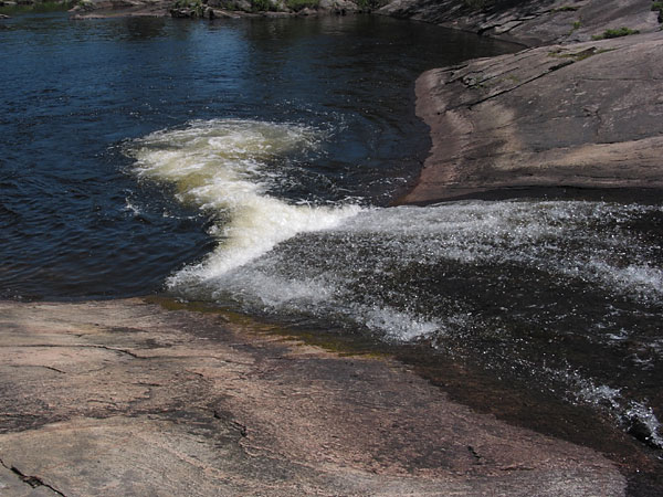
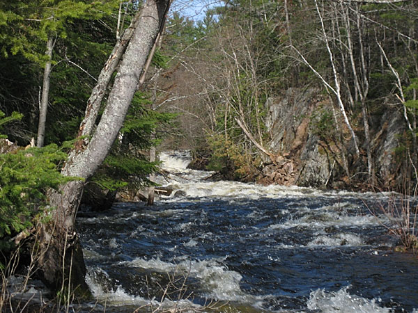
(photo by Bob: 2006-05-09 - explore)
The Cascades on the Barron River between High Falls Lake and Brigham Lake. (2006 May)
Most groups seem to go via the lakes; we suspect that a contributing factor is that many want to camp on Opalescent Lake. Also the larger groups may want to minimize the number of portages.
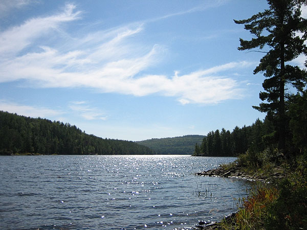
(photo by Diana: 2010-06-25 - map - explore)
Ooze Lake as seen from the end of the portage from High Falls Lake. (2010 June)
(photographed: 2010-06-25 - map - explore)
The portage between Opalescent Lake and Brigham Lake is a little rough near the crest of the hill. (2010 June)
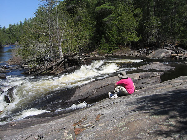
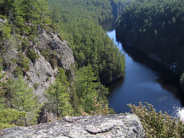
Visiting the Barron Canyon From a Base Camp
At the top of the Barron Canyon looking downstream. (2007 April)
The most straightforward overnight trip through this area is to start at Achray and finish at Squirrel Rapids. However, this requires leaving a car at Squirrel Rapids, or equivalent logistics. Many prefer an out and back trip, starting and ending at Achray and visiting the canyon as a day trip from a base camp. There are several choices for base camps; none is perfect.
St. Andrews Lake is a very nice lake and is relatively convenient to the water slide, but a trip to the canyon and return is a significant undertaking. A day trip from the middle of St. Andrews Lake to the bottom of the Barron Canyon and return is about 20 km. This distance includes 14 portages totalling a little over 5 km (2). Camping on St. Andrews Lake and day-tripping to the canyon would not be our choice.
(photo by Diana: 2007-09-18 - explore)
Looking south on St. Andrews Lake from near the portage to High Falls Lake. (2007 September)
High Falls Lake is not particularly convenient to either the water slide or the canyon. The campsites are rough.
(photo by Bob: 2009-07-13 - explore)
High Falls Lake is rugged and picturesque. (2009 July)
Opalescent lake is not convenient to the water slide but is more convenient to the canyon. From mid-Opalescent Lake to the bottom of the canyon and return is a little over 11 km including 6 portages totalling 2.5 km. It is about half the distance and half the portaging of day tripping from St. Andrews Lake.
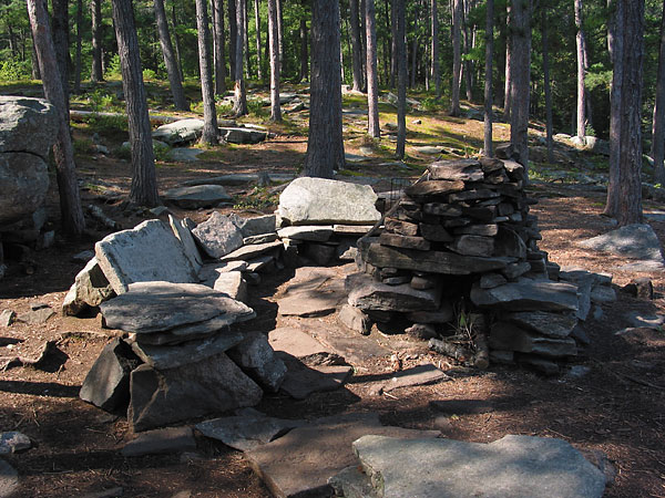
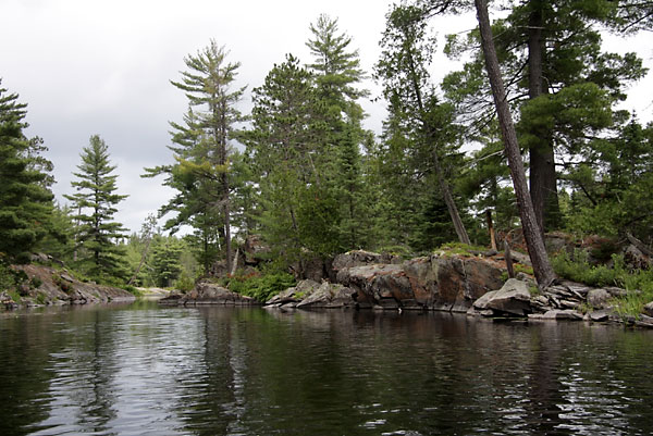
(photo by Bob: 2007-08-29 - explore)
The "stone couch" campsite on Opalescent Lake. (2007 August)
Cork Lake is a little farther from both the water slide and the canyon than Opalescent Lake, but is a pleasant little lake and it sees fewer canoes.
(photo by Bob: 2007-08-28 - explore)
Cork Lake at sunset. (2007 August)
Brigham Lake is closer to the canyon than Opalescent Lake, but is not as nice a lake.
If you want to establish a base camp and are interested in both the water slide and the canyon, there is no perfect choice; all are compromises. If you have the time, a good solution would be two nights on St. Andrews Lake followed by two nights on Opalescent Lake (or Cork Lake).
Canoeing the Barron Canyon as a Day Trip
There are at least three ways to canoe the Barron Canyon as a day trip:
Start at the Brigham Lake parking lot and paddle downriver through the canyon, finishing at Squirrel Rapids. This is arguably the best day trip, but it requires multiple vehicles (so as to get back to the start point). It is often suggested that you could leave a bicycle at Squirrel Rapids. In theory this could work, but we have no personal experience with this approach, and don't know anyone who has done it. The occasional tripper has been known to hitchhike back to the start point, but this is obviously not a reliable way to go.
Start at Squirrel Rapids and paddle upstream, portaging around Cache Rapids, continue paddling upstream and through the canyon to the foot of the portage around Brigham Chute. Leave your canoe here — out of the way and not in the poison ivy — and walk the portage to have a look at Brigham Chute. Turn around and return to Squirrel Rapids by the same route. In our opinion, this is the best single-car solution.
Start at the Brigham Lake parking lot and proceed downstream on the Barron River, portaging where necessary. Turn around at the bottom of the canyon and return.
We think starting at Squirrel Rapids is better than starting at the Brigham Lake parking lot because, although the total distance is greater, the portaging is easier. (The final portage back up to the Brigham Lake parking lot is especially fun at the end of a day's tripping.)
Paddling upstream on the Barron River against the current is not an issue.
(photo by Bob: 2008-05-13 - explore)
The portage just above the canyon is around Brigham Chute. If you visit the canyon from downstream, it is worthwhile paddle up to the portage and then walk to the top to have a look. It is quite impressive at high water. (2008 May)
(photo by Diana: 2007-04-25 - explore)
Cache Rapids in early spring. This is the only portage encountered travelling upstream between Squirrel Rapids and the Barron Canyon. (2007 April)
Outfitters
There are two outfitters located on the Barron Canyon Road. They are:
Algonquin Bound located near the Priebe Road intersection.
Algonquin Portage located near the Station Hill Road intersection.
Both of theses offer full outfitting and canoe rentals and can help with pickups, deliveries and car shuttles. As we have no personal experience with either, we make no recommendations. Please contact them directly for more information.
Additional Information
The route to Cork Lake from St. Andrews Lake via Marie Lake and Length Lake is not recommended. The portage from St. Andrews Lake to Marie Lake is Heart Attack City - a real brute of a climb. We don't understand why anyone would take this route unless they are naive enough to believe the fish stories about Marie Lake.
Looking back towards St. Andrews Lake (just visible near the centre of the photo) on the portage to Marie Lake (2004 September).
The High Falls Trail is sometimes flooded in the spring. For an early spring visit to the water slide on foot, it is more certain — although longer — to go via the Eastern Pines Hiking Trail.
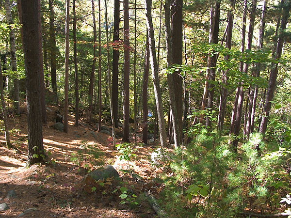
The High Falls Trail at about the half way point in May 2004
There is no route along Length Creek from Cork Lake to the Barron River; the creek is not navigable. We know of no easy way to visit or view the "Turret" or the "Wall" that are indicated on the Chrismar Map of the area.
We are aware of no practical route from the Barron River to the top of the canyon walls. (Note that rock climbing is not an allowed activity within the Park.) If you want to see the canyon from the top, take the walking trail off of the Barron Canyon Road.
(photo by Bob: 2006-04-27 - explore)
The Barron Canyon as seen from the walking trail off the Barron Canyon Road. (2006 April)
There is poison ivy all over this area: near the water slide, in the canyon, on the High Falls Trail, and especially at the ends of the portages along the river (3). Be careful where you set down your packs and where you sit down.
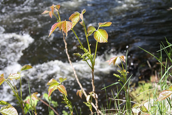
(photo by Bob: 2009-06-03)
Some particularly vigorous poison ivy growing at Brigham Chute. Most poison ivy encountered is closer to the ground; more-vine like than bush-like. (2009 June)
Discussion
If you have any comments, alternative opinions or further questions, send us an email (bob at mcelroy dot ca), and if appropriate we will revise this page or include your comment here. Please indicate what name or "handle" you would like associated with your comment.
Visiting the waterslide from Opalescent Lake
In 2009 I advised Michael McMullen that in my view, Opalescent Lake is not a very practical choice for a basecamp for a visit to the pools and waterslide, especially with small children. Michael's experience suggests that my advice was too conservative. Michael reports:
We did end up camping on Opalescent Lake two nights (we got the primo point campsite) and doing the falls as a day trip. It all went very well and we didn’t find it difficult at all (aside from the 2x portage from Opalescent to Ooze Lake). We hugged the north side of High Falls Lake and went over a little ledge that my kids called the “One foot portage”. We tied up the canoes at the end of this little lake and walked along the shore to the small lake right below High Falls. It was a very easy walk. We went the first week of September and there was very little undergrowth. From the base of High Falls we just followed paths up to the pools and slide. I certainly wouldn’t portage this route but I wouldn’t classify it as difficult. We had two nine year olds and two six year olds and there was no issue though our kids have been tripping since they were two.
Micahel also noted that poison ivy was everywhere so people should be on the lookout.
In response to Michael's comments and others that we have seen on the web, Bob and his friend Richard checked this route out. Their experience is reported here: To High Falls and the Water Slide - the hard way. Their conclusion is to not recommend this route.
Notes
- The "High Falls Trail" starts on the Barron Canyon Road about 250 m west of the Brigham Lake Parking Lot. The trail is not signed nor, as far as we know, is it mentioned on any MNR publication or map. Clearly, however, it is officially recognized and maintained. Jeffrey McMurtrie, on his Algonquin Park Map, refers to it as the High Falls Trail. In the absence of a better or more official name, that is the one we will use here.
- Distance calculation from St. Andrews Lake assumed travelling through the lakes on one leg of the trip and along the river on the other.
- There may be poison ivy along the Eastern Pines Hiking Trail as well, but we don't explicitly remember seeing it there. However, we don't often travel that way.
Sources
Chrismar (1999), Barron/Achray, A Chrismar Adventure Map.
Friends of Algonquin Park; Canoe Routes of Algonquin Park.
Friends of Algonquin Park (undated); Barron Canyon Trail Guide.
Jeffrey A. McMurtrie (2009), Algonquin Provincial Park & The Haliburton Highlands Canoeing and Exploring Map, Version 2.0. Free Algonquin Park Map
Michael W.P. Runtz (1993), The Explorer's Guide to Algonquin Park, Stoddard Publishing Co. Ltd.