
A Hike to Eustache Lake
An account with photographs of a hike to Eustache Lake in Algonquin Park.
2003 October 07
Today, my friend Richard and I day-hiked into Eustache Lake in north-eastern Algonquin Park. According to the park map:
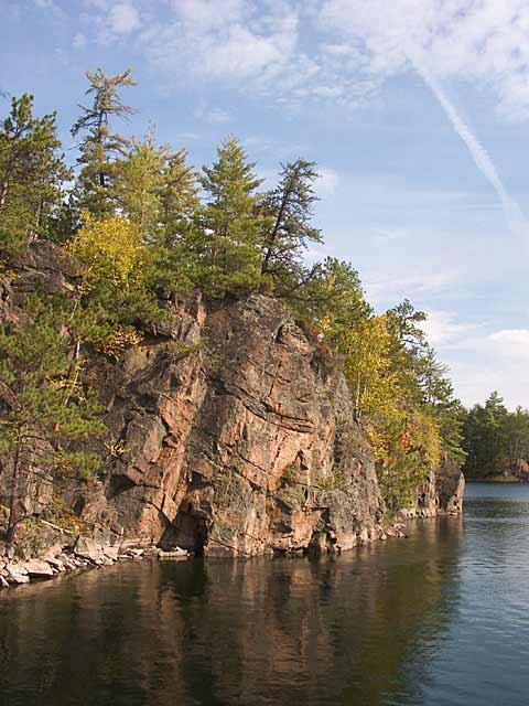
The deepest lake in Algonquin, Eustache is ringed by 25m cliffs, which continue down, through its amazingly clear waters for another 90m.
We started at the former site of the Lake Traverse Railway Station — now just a clearing beside a marsh. We walked along the abandoned railway line and then onto the Devil's Cellar Rapids portage along the Petawawa River.

Richard looking for "the line" through the bottom of Devil's Cellar Rapids
Leaving the Petawawa River, we took the portage into Eustache Lake; the trail was pretty good for an unmaintained portage. But it's all uphill, crossing four 50 ft. contour lines from the river to the lake. When we reached the lake, we bushwhacked along the north shore. Because of the rocky nature of the terrain, the bush is relatively open. But it's quite rough and hard going — lots of broken rock. You need to choose your route carefully to avoid needless ups and down. The cliffs are spectacular, but it's hard to truly capture that in a photograph.

The view from our lunch stop
We only made it about half way along the north side cliffs, before time considerations compelled us to turn around. Then, of course, the sun came out.
The view from the westernmost campsite on the north shore of Eustache Lake. The cliffs are much lower here.
All in all, a most enjoyable hike. Beautiful and spectacular country, and we didn't see another soul.