Early Spring in the Barron Canyon
Last Wednesday (2007 April 25), Bob and Diana undertook a day trip through the Barron Canyon on the Barron River in Algonquin Park by canoe. Although our objective was to photograph the small waterfalls that plunge down the canyon walls during the spring runoff, no excuse is really needed for a trip into the Park. We started at the launch point just above Squirrel Rapids at about 9:15 a.m. and traveled upstream, portaging around Cache Rapids, paddling through the canyon, and visiting Brigham Chute. After eating lunch in the canyon, we returned by the same route, arriving back at the start point around 4:15 p.m.
It was a beautiful day, clear and sunny, with only a hint of clouds to the south. The morning started at -3C, but soon began to warm up as the sun rose. Much of the time it was glassy calm, with only occasional light winds.
2007 April 25
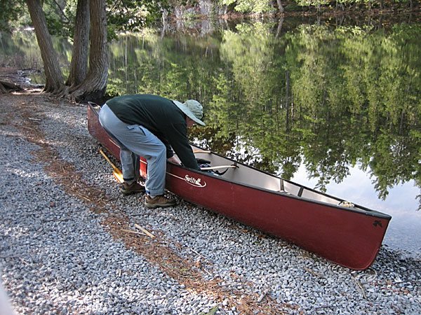
Bob preparing the canoe at the Squirrel Rapids access point.
The line of dead pine needles along the shore marks this year's high water level. While one may object to the artificial crushed stone riverbank on aesthetic principles, the heavy traffic at this spot requires some extra measures to control the erosion (which isn't "natural" either).
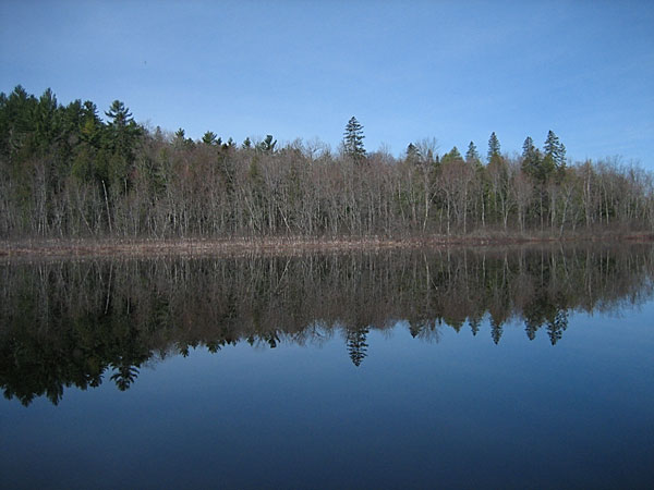
The south shore of the Barron River upstream from Cache Rapids. Ignace Creek flows in on the north shore close to this point. Here we saw a couple of muskrats swimming in the river, and heard spring peepers and numerous birds, including a bittern in the marshy area at the creek mouth. A hint of colour is just starting to appear in the vegetation.
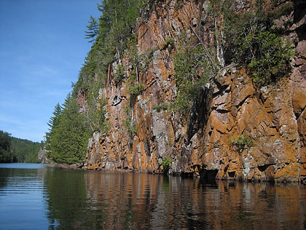
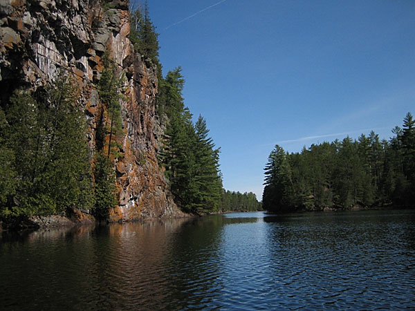
We reached the canyon in about an hour and a half. The orange colour on the cliff is due to Xanthoria lichen, which indicates that the rocks contain lime. The presence of cedar trees also indicates lime.
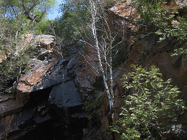
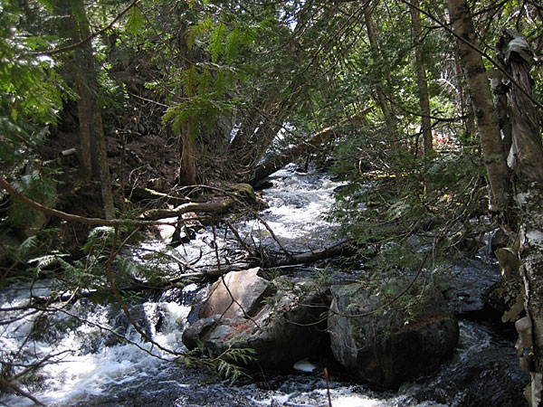
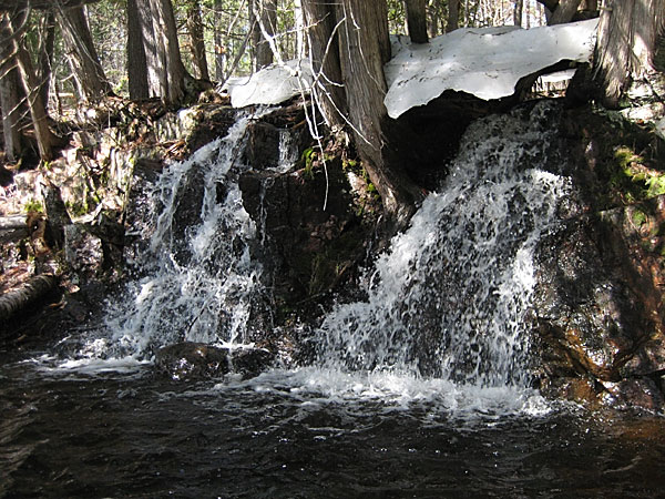
One of many "micro falls" that cascade into the canyon in the spring and disappear later in the season. However, because of the very light snow fall during the past winter, the volumes of water falling into the canyon were somewhat less than we had hoped for.
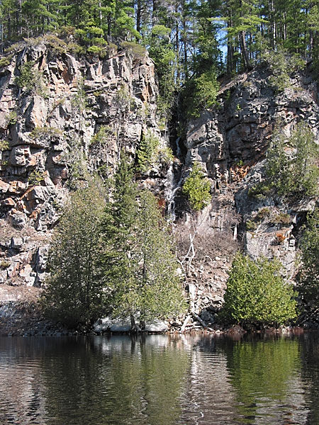
A somewhat larger ribbon falls. This falls flows all summer but at a very low volume.
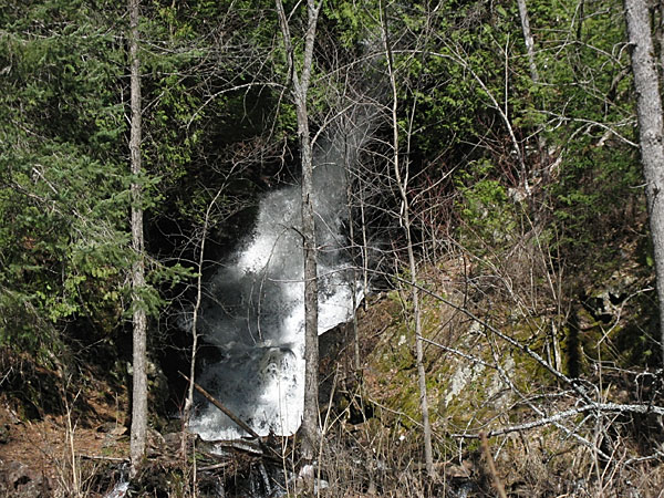
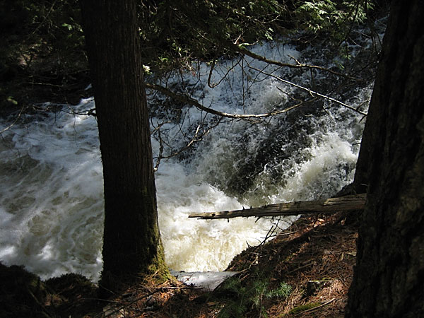
This waterfall occurs where Hardwood Creek falls into the canyon, and it flows all year. Unfortunately, it is difficult to photograph since the view of it is obstructed by trees, especially when the leaves come out later in the season. We noted, however, that the local beaver population has been active in trying to "improve" the view.
(This is the same creek that we refer to as "an unnamed creek along the Achray Road" in An Early Spring Day in Algonquin Park.)
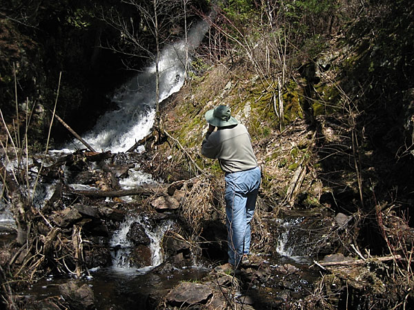
Bob photographing Hardwood Creek Falls.
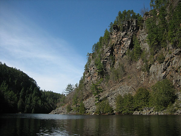
The Capes along the South Branch of the Petawawa River (to use the old nomenclature). The most spectacular cliffs of the Barron Canyon are along the north rim (to the right in this photo). However, the highest local elevations actually occur south of the canyon.
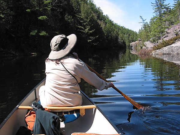
At the top of the canyon, Diana in the bow.
Upstream of the canyon, the river valley is still deep, but much narrower and with more vegetation. It appears that micro-climate here is cooler than in the canyon. There were still large chunks of ice in many places on the northern exposure.
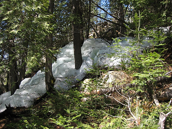
Even on the northern shore of the river (southern exposure), there were a few large masses of ice remaining under the cedar trees.
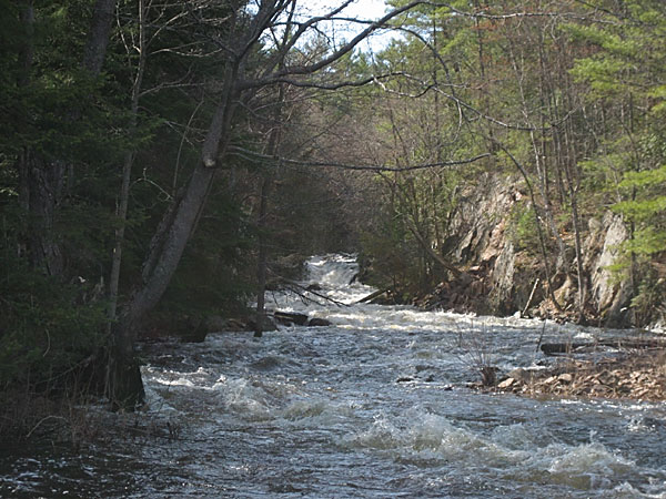
The turnaround point for the day was Brigham Chute. We left the canoe at the bottom of the portage and walked up the trail to photograph the falls. This view is looking upstream just above the falls.
When traveling downstream, caution is required in approaching the top of Brigham Chute. This is more easily accomplished now that the map shows the portage on the correct (north) side of the river. On our first trip down the Barron River we were relying on the "Tom Thomson" park map (early 1970s), which showed the portage on the wrong (south) side of the river.
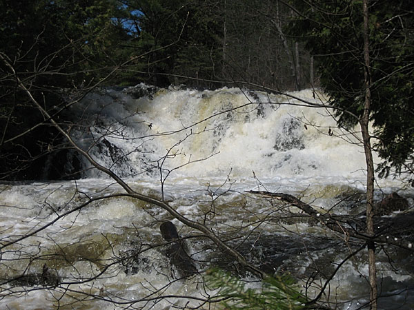
The falls at Brigham Chute as seen from below. Given the volume of icy water flowing over the falls at this time of year, and the large chunks of broken rock forming the river bed, being swept over the falls would likely prove fatal.
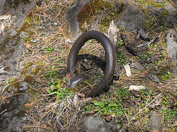
The name Brigham Chute commemorates Charles L. Brigham, one of the earliest lumbermen operating on the Barron River (at least as early as 1842). Clearly the falls and rapids below were a significant obstacle to the downstream transport of logs. There was probably a log chute or slide bypassing the falls on the south side of the river. This ring, embedded in solid rock, was most likely used to anchor one end of a boom preventing the logs from going over the falls.
After visiting Brigham Chute, we paddled back down into the canyon and ate our lunch on a huge sunny rock on the north shore. While there, we observed a bat catching insects above the water. At this time of year, overnight temperatures are close to or even below 0C, meaning there are no insects active at night, so the bats are forced to hunt in daylight after the air warms up.
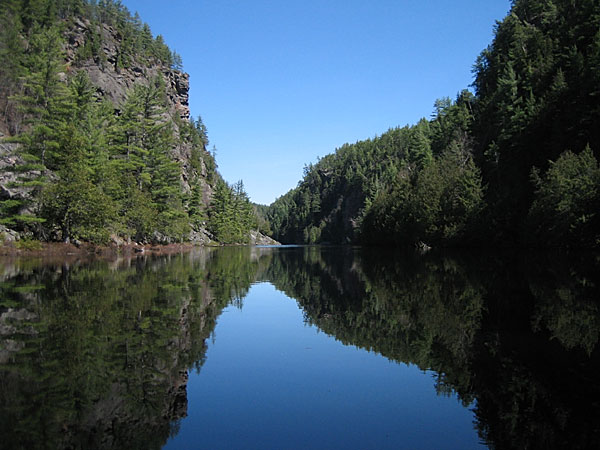
At the top of the Barron Canyon looking downstream.
The Ottawa Valley is a rift valley, a dropped down block of bedrock tens of km wide, known as the Ottawa Bonnechere graben. The Barron Canyon lies along a fault that runs across the graben. The graben (along with the St. Lawrence rift) was formed some 570 million years ago during the break up of the super continent Rodina. The faults were reactivated during the break up of the continent Pangea about 150 million years ago.
Leaving the Barron Canyon at the downstream end.
The canyon was opened up and scoured of debris 10,000 years ago by the Fossmill drainage following the last ice age. However, it is incorrect to assume that the entire drainage flowed through the Barron Canyon. The drainage comprised a massive river bounded by the line of hills west of Grand Lake and the hills north and east of the Petawawa River. The canyon rims would have been merely islands in this massive river and much of this picture would have been underwater.
Cache Rapids provided another impediment to the driving of logs down the Barron River. On the return trip, we walked back up the portage and spent some time photographing the rapids.
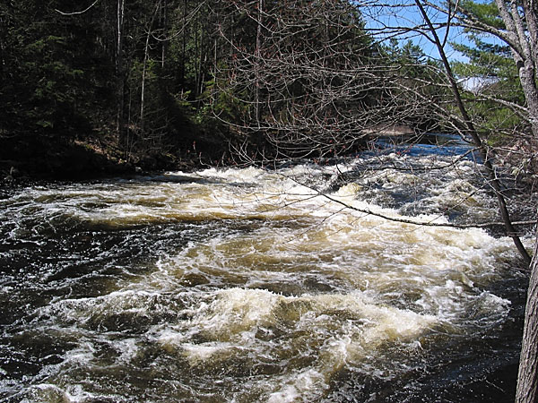
The northern channel of the Barron River at Cache Rapids
The southern channel of Cache Rapids, looking upstream.
This small creek falls into the Barron River just downstream from Cache Rapids. It drains a tiny, unnamed lake that lies just west of the Achray Road about a kilometer beyond the Barron River.
An excellent day! It eventually warmed up to 15C, remaining sunny and mainly calm. Although the runoff was a little lighter than we had hoped, we were in no way disappointed. (And if there had been significantly more water in the bush, we most certainly would have ended up with wet feet on the Cache Rapids portage.)
We first paddled this this route 33 years ago, and have done so a number of times since then. However, this is the first time that we have ever had the river completely to ourselves. From when we launched the canoe to when we took it out of the water, we didn't see or hear another soul.