Climbing Out of the Barron Canyon
2015 May 29
The question occasionally arises as to whether it is possible to combine a paddle trip through the Barron Canyon with exploring the hiking trail at the top. My answer to this question has always been that this is not practical; the hiking trail is not accessible from the river. However, in the last year or so, I have come to suspect that there perhaps is a route to scramble up and out of the canyon starting just a little downstream of Hardwood Creek. Recently, my friends Ric and Richard and I (Bob) decided to give it a try. Some photos from our climb are presented below.

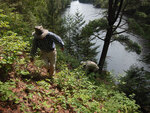
(photo by Bob: 2015-05-29 - explore)
Ric and Richard about to start our climb. They were questioning my sanity at this point, but were polite about it.
The shore was too steep to pull the canoes out of the water; we just tethered them.
Although not particularly evident in the photo, we are sitting in a patch of poison ivy; it is everywhere along the Barron. I'm not showing any symptoms but I haven't heard from Ric or Richard recently.

(photo by Bob: 2015-05-29 - explore)
Climbing up. Steep and somewhat unstable — scree with a thin cover of vegetation.

(photo by Bob: 2015-05-29 - explore)
The view down river from a little way up — about the same location as the previous photo.

(photo by Bob: 2015-05-29 - explore)
We left our packs back in the canoes because we didn't want to be over balanced. However, if the plan had been to bushwack over to the hiking trail, we would have wanted them.

(photo by Bob: 2015-05-29 - explore)
We're up. We're only 20 - 30m above the river at this point but the steep stuff is done.
Notice the "spine" along the top of the "cliff".
We bushwacked over to Hardwood Creek — probably less than 200m. We were regretting that we didn't bring any flagging tape with us (to ensure that we could find our way back down), but it's probably just as well since we returned via a slightly different — but better — route. I suspect that the use of flagging tape is against park rules.
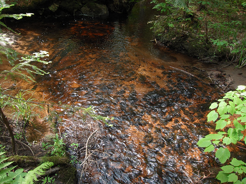
(photo by Bob: 2015-05-29 - explore)
The clear, tannin stained water of Hardwood Creek.
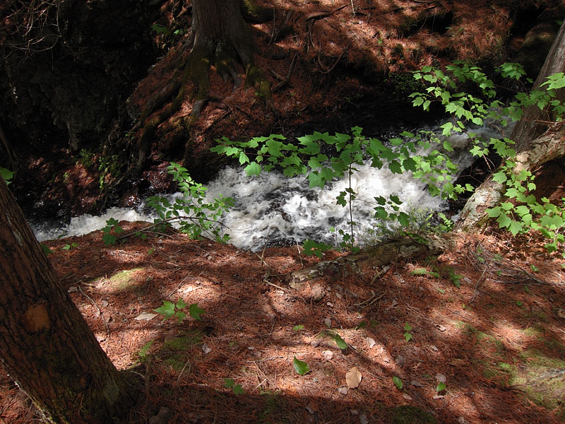
(photo by Bob: 2015-05-29 - explore)
Over it goes, dropping into the canyon.
I didn't notice it at the time, but that certainly looks like a blaze on the cedar tree to the left in the photo

(photo by Bob: 2015-05-29 - explore)
The top of the falls on Hardwood Creek looking down. The perspective of the photo does not convey the steepness of the drop.

(photo by Bob: 2015-05-29 - explore)
Looking across the canyon to the south wall. It is interesting to note that the land south of the canyon is actually higher than to the north, but that you get the opposite impression when paddling through. The leafless tree at the bottom of the photo is at the mouth of Hardwood Creek.

(photo by Bob: 2015-05-29 - explore)
Along the spine of the north canyon wall. Unfortunately, there are no good vistas along here.

(photo by Bob: 2015-05-29 - explore)
Looking for the route back down. We didn't doubt that we could find our way back down; but we wanted to do so under control and arrive back where our canoes were moored. It turned out that our route down was easier and more direct than our climb up.

(photo by Bob: 2015-05-29 - explore)
The "path" down is evident in this photo.

(photo by Bob: 2015-05-29 - explore)
This section was steep enough that inching down on one's butt was the safest way. Backwards on your hands and knees would be another approach.

(photo by Bob: 2015-05-29 - explore)
Back at the bottom. This location was maybe 15m farther upstream from where we started, but a natural path, evident in this photo, provides the better route. It was not clear whether this "path" was a natural gulley (perhaps an abandoned creek bed), an old trail or a modern path — perhaps just a game trail.
In retrospect, this climb was somewhat anticlimactic. Certainly, it was intimidatingly steep and the surface was somewhat unstable, but even as inexperienced climbers, we never felt that we were recklessly risking our necks. And the steep part was not that high. It got our heart rates up but was certainly within the capabilities of these three old guys. That said, there is a real danger of slipping, it is certainly not suitable for children and the route would probably become quite treacherous in wet conditions.
Once we were up, the bushwack over to Hardwood Creek was straightforward — we could hear the falls — although the bush away from the cliff edge was thick.
From the top of the falls on Hardwood Creek, it would only be a bushwack of less than a kilometre to connect with the Barron Canyon Hiking Trail. Certainly there would be an elevation gain of several tens of metres, but it is spread out rather than concentrated in the form of a cliff. Thus I am quite confident that this would be a possible route to connect with the hiking trail and thus access the high point of the north canyon wall. Whether this constitutes a sensible or practical side trip to augment a paddle through the canyon is another matter. But these comments are theoretical; we did not attempt to connect with the hiking trail and thus cannot vouch for the route.
Disclaimer: This account is solely a record of what we did and is not a recommendation to others. You are solely responsible for your own route selection and safety.