Trip Log - Brent to Burntroot Lake and Return
An account of a seven night canoe trip in Algonquin Park. We started at Brent on Cedar Lake, camped on the Petawawa River above the "timber slide" and then proceeded to Catfish Lake via Narrowbag Lake. We camped for two nights on Catfish Lake and then proceeded to Burntroot Lake via the Petawawa River. We stayed on Burntroot Lake for three nights before returning to Catfish Lake for a single night. On the last day, we returned to Brent via Luckless Lake and the Nipissing River. We checked out the alligator remains on Catfish Lake and at Barnet Depot on Burntroot Lake.
Most of our recent forays into Algonquin Park have been day trips or base camping close to an access point. It has been 25 years since we have undertaken a real travelling trip and we weren't sure whether, as a pair of senior citizens, we were still up to it. So we decided to return to Burntroot Lake (probably our favourite lake in the Park, although we knew it then as Portal Lake). We figured that the Stacks Rapids portage would be a good test.
We are forgoing our usual style of basing our account directly on our unabridged trip log — the one from this trip is a little long and wordy. However, for anyone interested, our unabridged diary may be found here: Trip Diary — 2014 September 03-10 — Brent / Catfish Lake / Burntroot Lake
2014 September 03 (Wednesday)
Brent to the Timber Slide
(photo by Diana: 2014-09-03 - map - explore)
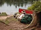
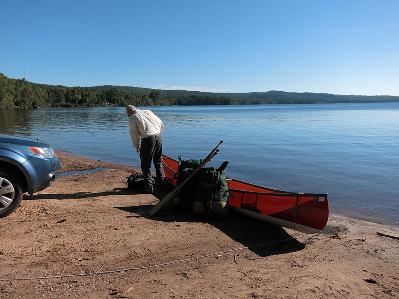
Loading up on the beach at Brent. Once again, the Cedar Lake gods were smiling.

(photo by Diana: 2014-09-03 - map - explore)
The falls on the Petawawa River just upstream of of Cedar Lake. You used to be able to find the remains of old logging works here, but these are all gone now. The grave of A. Corbeil remains, however.

(photo by Diana: 2014-09-03 - map - explore)
We refer to this location, the next falls upstream on the Petawawa River, as the "timber slide", because, until relatively recently, there were the remains of a timber slide here (see Day Trip Up the Petawawa River from Brent).

(photo by Diana: 2014-09-03 - map - explore)
The top of the portage around the timber slide.
And about from the same spot in 1975 (from Trip Log - Canoe Lake to Brent and Return - 1976 May 14-25).
We camped for the night at the campsite opposite the top of the portage. We had elected to save the Stacks Rapids portage for the second day.
2014 September 04 (Thursday)
Timber Slide to Catfish Lake

(photo by Bob: 2014-09-04 - map - explore)
Diana cresting "Unicorn Hill" on the Stacks Rapids Portage.

(photo by Bob: 2014-09-04 - map - explore)
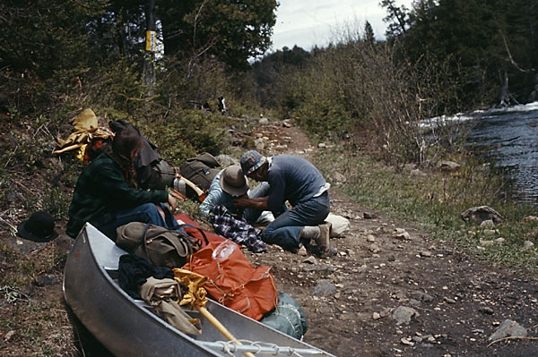
Diana relaxing at the end of the Stacks Rapids Portage and updating our diary. It took us about three hours to do the portage, which included a rest and snack break at the top of the hill. That's about twice as long as our best time when we were younger. But this time we opted for a full double carry — four loads across the portage — rather than leapfrogging three loads across as we used to do. (We reverted to three loads later in the trip when we had eaten our food weight down somewhat.)

(photo by Diana: 2014-09-04 - map - explore)
The old logging dam at the outlet of Catfish Lake is still hanging in there.
The day was overcast and quite humid. We reached our campsite on Catfish Lake (northernmost site on the lake) by mid-afternoon. We felt that we had acquitted ourselves well on the portage but nevertheless, we were quite tired.
We didn't see anyone all day.
2014 September 05 (Friday)
Catfish Lake
Friday was a lazy day in camp. We were pseudo wind bound. If we had had to travel we could have, but it was much too windy for a pleasant recreational paddle. The wind abated a little after lunch and we went for a short paddle down to the narrows, checked out the alligator and other campsites, etc. We decided that our campsite was as good as any, especially in a blow.

(photo by Bob: 2014-09-05 - map - explore)
Diana with the alligator remains on Catfish Lake.

Here's a somewhat similar photo from 1978.
We heard some distant thunder that evening with light rain starting around bedtime. Both the wind and rain died away overnight.
Again, another day without seeing anyone.
2014 September 06 (Saturday)
Catfish Lake to Burntroot Lake
Saturday morning dawned calm with high overcast and broken clouds out of the west. As we paddled down Catfish Lake we were surprised to see that another party had arrived the previous day and had camped, illegally, on the alligator island. We also saw another group — a single canoe — heading south. We caught up with them at the Catfish Rapids Portage, two older guys — i.e., about our age — on a loop out of Kiosk (Kiosk / Cedar / Burntroot / Nadine / Maple). They clearly knew what they were doing. Although we were heading in the same direction, they finished the portage ahead of us and we never saw them again.

(photo by Diana: 2014-09-06 - map - explore)
The Petawawa River upstream of Catfish Rapids.
We had conservatively reserved the site at Cedar Rapids as our destination for the night. However, as the site was unappealing, the day was young, and the park interior was pretty much empty, we pushed on to Burntroot Lake.

(photo by Diana: 2014-09-06 - map - explore)
Bob enjoying the long paddle up Perley Lake — or, at least, Perley Lake always seems long — much longer than it is — like Longer Lake and Smith Lake.

(photo by Diana: 2014-09-06 - map - explore)
The "root cellar" near the end of the portage into Burntroot Lake. We don't remember the doorway being this distorted, but we don't seem to have any old photos.
(photo by Diana: 2014-09-06 - map - explore)
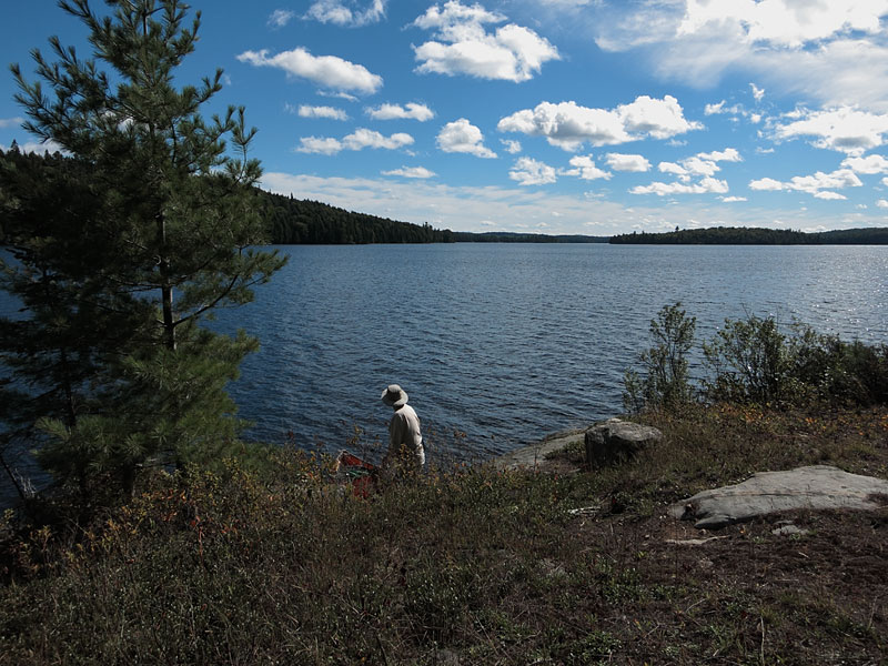
View from the little island campsite on Burntroot Lake. This used to be one of our favourite campsites but it is no longer in service. We camped farther down the lake on the shore. The official island campsites that we checked were either totally exposed to the wind, or totally beaten to death — usually both.
After checking out several sites — perhaps we're just too fussy — we chose the site on the point on the eastern shore of Burntroot Lake. The site and tent space were fine but the landing and water access were the pits.
The sky was clear with a solid north west wind.
2014 September 07 (Sunday)
Barnet Depot
We spent the morning (albeit, a late start) exploring Barnet Depot. Everything is getting pretty grown in — not much left in the way of buildings, etc. We found and photographed what was left of the alligator. It too is pretty far gone. Finding it was a bit of a challenge but we weren't going to leave without visiting it. However, enough yahoos have found it and “salvaged” it and carved their initials on it and left their wine bottles in it. Let it rest in peace and decay in dignity.

(photo by Bob: 2014-09-07 - explore)
The poor old alligator rotting away at Barnet Depot.

(photo by Diana: 2014-09-07 - explore)

Here's how it looked in 1976. (See Alligators of Algonquin Park for more 1970s and '80s photos.)
The wind remained lively into the evening, shifting to the southwest and then dying at sunset.
2014 September 08 (Monday)
Burntroot Lake
By morning the wind had shifted all the way 'round to the south. A change was on the way, but when?
We spent the morning exploring the lake (but left enough unexplored for future trips).
(photo by Diana: 2014-09-08 - map - explore)
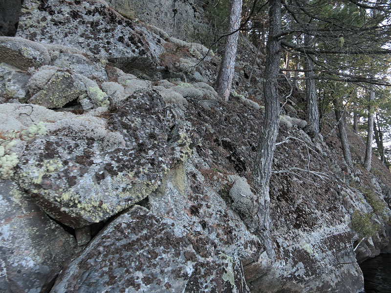
Small cliff in Whistle Bay. We have long been intrigued by the name "Whistle Bay", so we had to check it out. Indeed, as suspected, it was a perfect little echo chamber. What could be more fun than sailing your alligator in here and letting out a couple of blasts of the steam whistle? How else are you going to entertain yourself for months on end on Burntroot Lake?
For some alligator sound effects and a look inside the engine room under power (second video), check out Alligator Tug and Steam Alligator Tug Boat. While the engine is the same, the alligator of these videos is not a side-wheeler.

(photo by Bob: 2014-09-08 - map - explore)
Under the tarp on Burntroot Lake, reorganizing the food bags. The tarp is providing wind protection from the south. When we arrived at this site we needed protection from the north.
The wind continued blowing from the south. There was a red sunset but it was a less than convincing harbinger of good weather.
We haven't seen anyone on our three days on Burntroot Lake — nobody since the two guys at Catfish Rapids.
2014 September 09 (Tuesday)
Burntroot Lake to Catfish Lake
The wind blew out of the south all night with just a bit of a respite in the early hours. In the morning there was a little blue sky overhead but high overcast to the west. The sunrise was pink; the rain signs continued.
We packed up and headed back to Catfish Lake.

(photo by Diana: 2014-09-09 - map - explore)
The outflow of Portal Rapids on the Petawawa River. Note the grey skies to the west.
We camped on the site in the bay east of Turtle Rock; quite a nice site, with views to the west, north, and east. The wind had continued solidly out of the south all day but were were quite sheltered for that wind direction.
(photo by Bob: 2014-09-09 - map - explore)
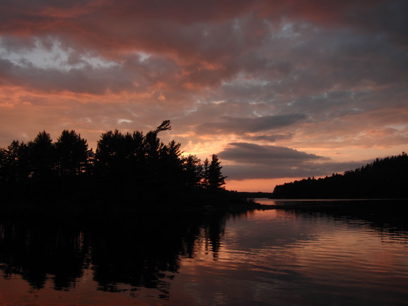
Beautiful sunset on Catfish Lake. But is it a "sailor's-delight" sunset?
2014 September 10 (Wednesday)
Catfish Lake to Brent via the Nipissing River
The morning was dead still; absolute quiet except for the odd mosquito and distant loon; slight mist on the water with little wisps of pink in the sunrise and a light overcast. An hour or two later a heavy mist descended, obscuring the hilltops. The mist slowly cleared as we made our way over to the Nipissing River.

(photo by Bob: 2014-09-10 - map - explore)
Lungwort (Lobaria pulmonaria) along the portage into Luckless Lake. While not rare, neither is it common. As blackflies are indicators of clear water, Lobaria Pulmonaria is an indicator of clean air.
(photo by Bob: 2014-09-10 - map - explore)
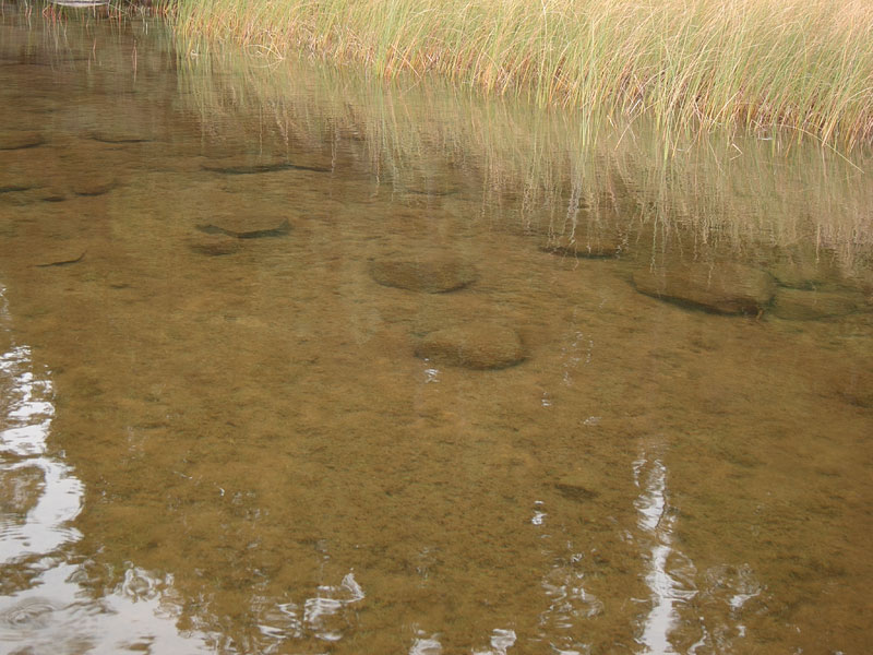
The clear waters of Luckless Lake. Is this perhaps a Green Headwater Lake?

(photo by Diana: 2014-09-10 - map - explore)
The long portage over to the Nipissing River

Here's Bob on the same portage in 1975, but going in the opposite direction (from Trip Log: Brent / Maple Lake / Catfish Lake Loop - 1975 August 11 to 21). Much more open than it is now.

(photo by Diana: 2014-09-10 - map - explore)
The Nipissing River at Rolling Dam. Note the dark tannin stained water. We think that the Nipissing is a much nicer river on a sunny spring day than on a gloomy overcast fall day.
Our plan was to camp on the Nipissing River at one of the campsites at Plumb Creek junction. We rejected the campsite at the end of the portage from Luckless Lake because of the off-putting mucky water access. We checked out Rolling Dam but decided to continue down river. The last Plumb Creek campsite was quite unappealing so we continued down river. In the end, we just kept going until we reached Brent.

(photo by Bob: 2014-09-10 - map - explore)
The last portage on the Nipissing River above Cedar Lake is up the side of an esker — that's why the takeout is so steep. We believe that this is the esker that shows that glacial Lake Algonquin did not drain down the Nipissing River valley (see The Mink Lake Sill).

(photo by Diana: 2014-09-10 - map - explore)
All was calm when we reached Cedar Lake.

(photo by Diana: 2014-09-10 - map - explore)
Safely back on the beach at Brent. The wind started to pick up (from the southeast) about half way across; the rain began when we were a few hundred meters from shore.
All in all, a good trip. We can still do it but we need to take it a little slower. And we lucked out with the weather. For the next two days, the weather was vicious — strong gusty wind and pouring rain.
For more photos, see our associated photo gallery Brent to Burntroot Lake and Return - 2014 September.