
Trip Log -- Four Nights on Whitson Lake (2021)
Septermber 2021
Several nights on Whitson Lake has become our "go to" September camping trip. It doesn't require a lot of travel or preplanning and thus it is ideal if we just want to squeeze in a trip. That was the case we faced in September 2021. We wanted to get away and it would be our only trip in 2021. We hadn't managed anything in 2020.
Our lives continued to be disrupted by the pandemic and other issues — not the least of which is getting older. And for a couple of retired old farts, we sure seem to have a lot of external commitments. However, a narrow window opened up which allowed us fit in four nights on Whitson Lake. The only issue was that the weather forecast for the first night was dire. But we decided to go anyway. It was the right choice. (It usually is.)
We didn't have a particular agenda for this trip but we thought we might explore some of the old logging roads on both sides of the lake.
While this write-up is based on our trip diary, this year's diary did not lend itself to being the direct narrative of the trip report.
Tuesday, September 14
We were a little late in getting away since some critter had got into our garbage that was out for collection. It needed to be cleaned up but we weren't aware of that until we were heading out the driveway. Even so, we passed the Sand Lake Gate before they opened and arrived at the put-in at about 9:30. The only traffic we saw on the Barron Canyon Road was a single camper van leaving. There were three cars in addition to ours in the McManus Lake parking lot.
The weather was iffy with a milky sky and an upriver wind. And the forecast was dire — wind from the SE at 20km/hr with gusts to 40 by early afternoon. It was forecast to switch to the SW with gusts up to 80 with thunderstorms and significant rain evening and overnight. Our hope was to be set up before it got rough.
Someone was camped at the sandy spit on McManus Lake. They had a solar panel on the beach and their canoe had an outboard motor. But they were not to be seen. That was the only sign of human life that we had seen since the van on the way in.
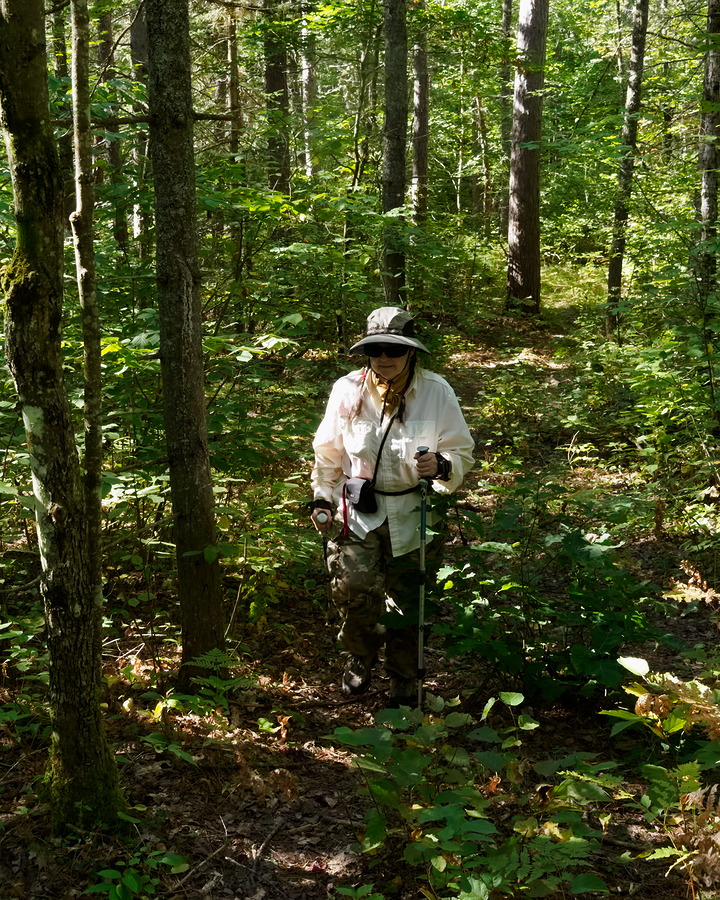
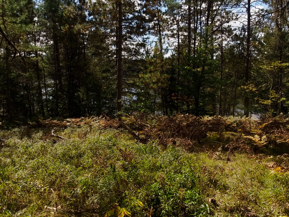
The water levels were low making it difficult to reach the portage take-outs. We made good time coming up McManus, about 30 minutes, but we spent 40 minutes on the portage to Smith Lake. The issue was mainly the rock hopping required from where we grounded the canoe, to reaching the start of the portage. (We like dry feet.) Bob is relatively sure-footed; Diana less so.

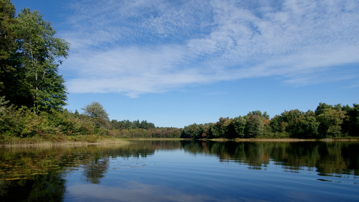
(photo by Diana: 2021-09-14 - map - explore)
The landing for the portage from McManus to Smith Lake. The closest we could get was to the extreme left of this photo.
You can wade the canoe up through here to Smith Lake if you want and don't mind getting wet, but it's usually simpler and more straight forward to just portage.

(photo by Diana: 2021-09-14 - map - explore)
Looking up into Whitson Lake from the campsite on the portage between Smith Lake and Whitson Lake. If the water is not too high, this is another portage that you can skip by wading but our choice going upstream is usually to take the portage. Going downstream, you just run it.
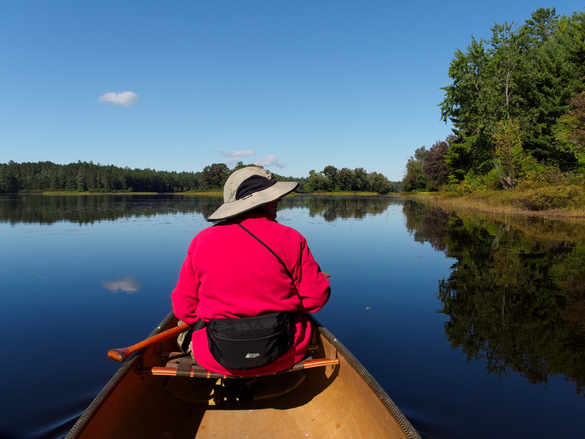
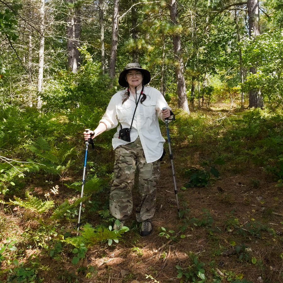
With respect to portaging, Diana had been on the hunt for a new pack. Over the past couple of years she had suffered from increasing joint problems in one shoulder and in her lower back, which made our older Duluth-style packs uncomfortable and difficult for her to carry. When Ostrom re-started production, she bought one of their new packs (a Winisk), sized to suit her torso, and was not disappointed. The suspension system is well designed and very adjustable, and she finds it surprisingly comfortable. And since she has always used a tump strap for portaging, the availability of that for the Ostrom pack was an added bonus.
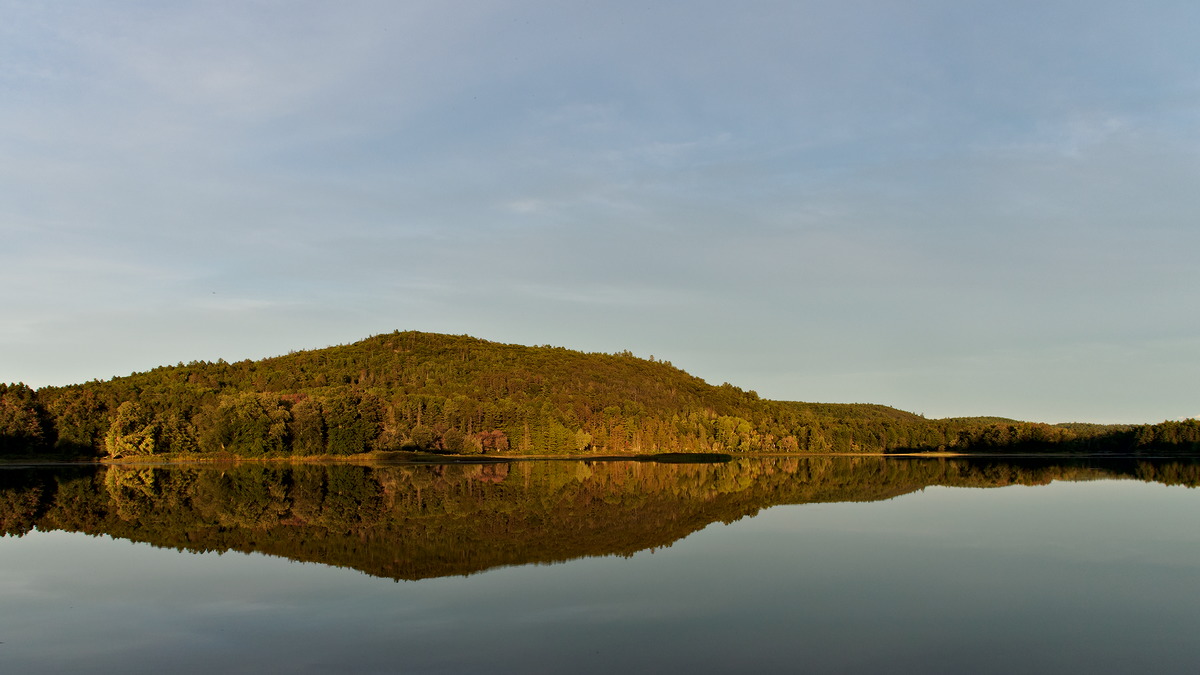
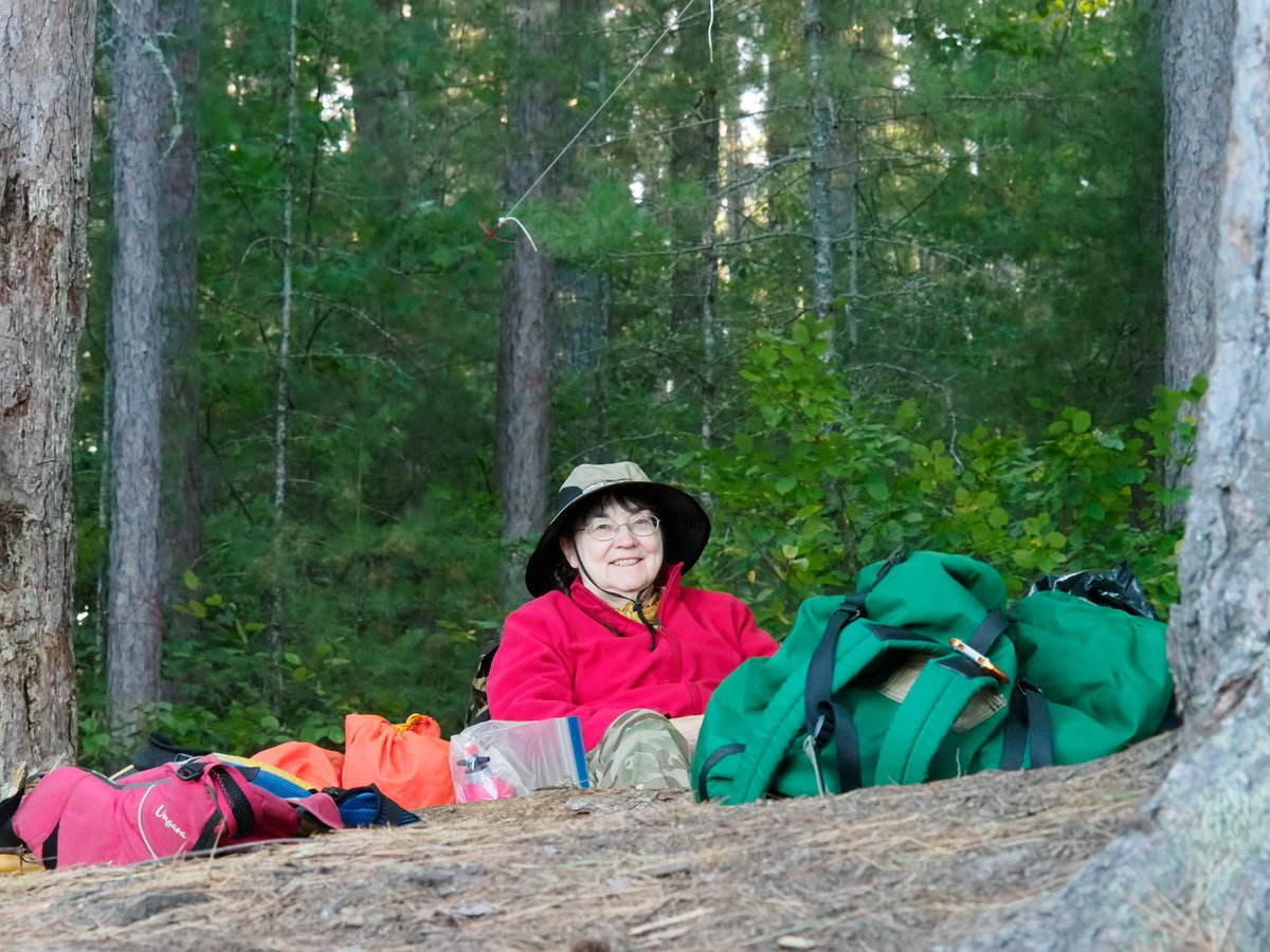
At about 13:30, we arrived at our campsite on Whitson Lake — most northwestern campsite on the main body of the lake.
The forecast was right and the wind did get a little lively making it somewhat of a challenge to pitch the tent and tarps. Diana found a spot back in the blueberry bushes to pitch the tent. It was on a slight slant but that would be a positive feature if we got the promised rain since most of the obvious tent spots on this site flood in heavy rain.
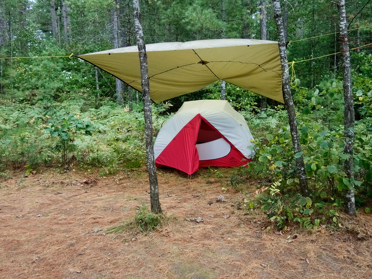
(photo by Diana: 2021-09-14 - map - explore)
Our tent pitched in the blueberry bushes with a tarp providing additional protection and sheltering the door.
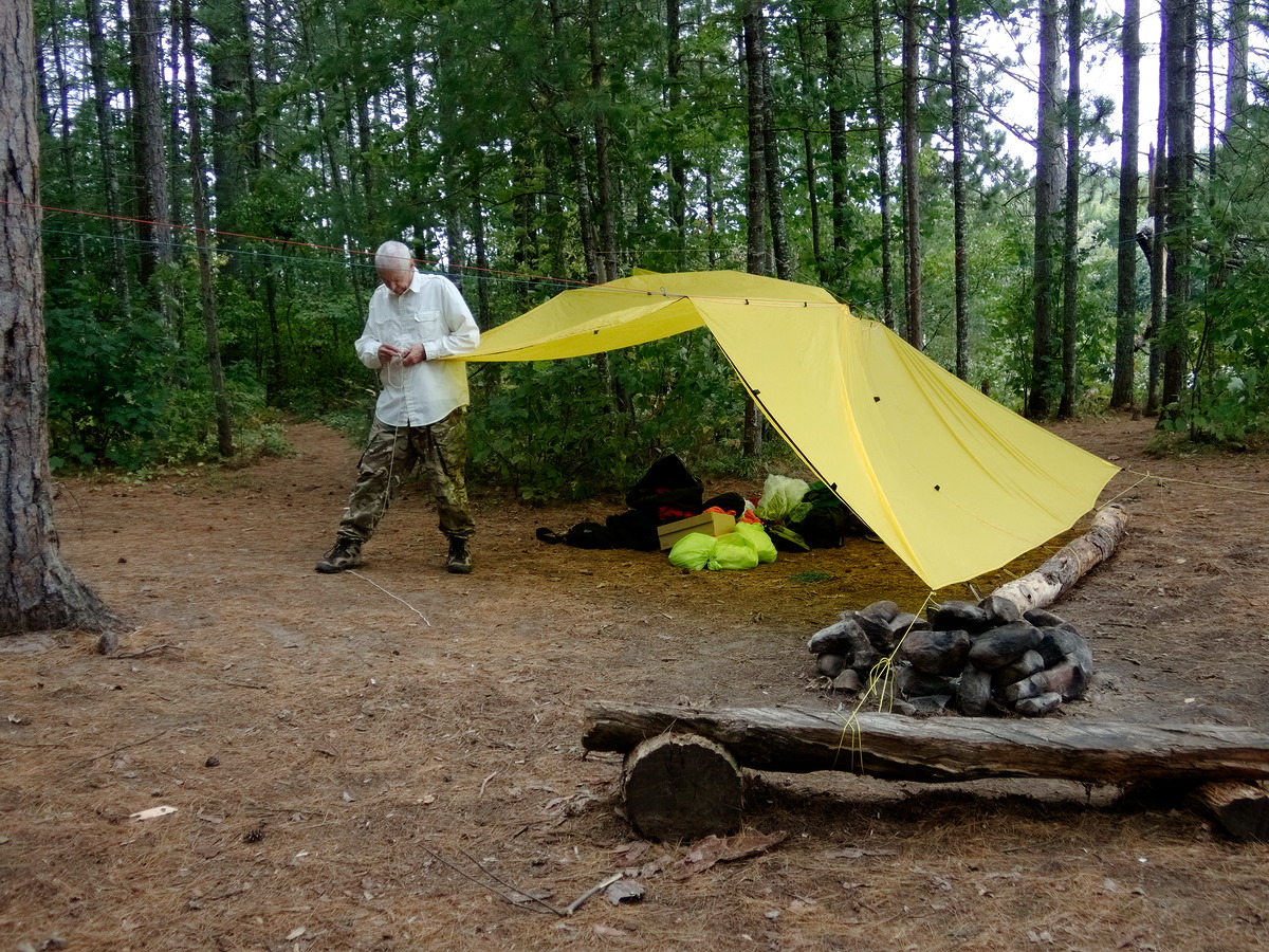
(photo by Diana: 2021-09-14 - map - explore)
Bob pitching the tarp in the wind. It was a slow iterative process. The front was sloped down to protect us from the onshore wind but destroying our view in the process.
The wind continued to blow and little by little Bob adjusted and improved the tarp setup. It was down to the ground – windbreak, shed setup – towards the lake so it was a little claustrophobic but it did provide some protection. The wind seemed to be increasing, still from the southeast — that is, right up the lake and directly into our campsite. Bob thought he heard thunder but Diana didn’t notice it.
As we were waiting for supper to rehydrate, the wind seemed less and there were rumbles in the distance. We had a few drops of rain. You wouldn’t have noticed if you weren’t paying attention.
After supper as we were sitting under the tarp, there was thunder and lightning all around us but minimal rain. Bob was trying to hang the food when the first line of storms went through. The hang did not go well. There was too much slack in one of the lines and we ended up with the food suspended such that it would be well protected from mice but little else. He managed to repair the situation in the semi-darkness, but it was a challenge. (Our food-hanging system is more complicated, but usually easier, than simply tossing a rope over a tree branch. It's great when it works, but sometimes there are "complications".)
The line of storms moved off to the east. The wind was much more benign than forecast.
Wednesday September. 15
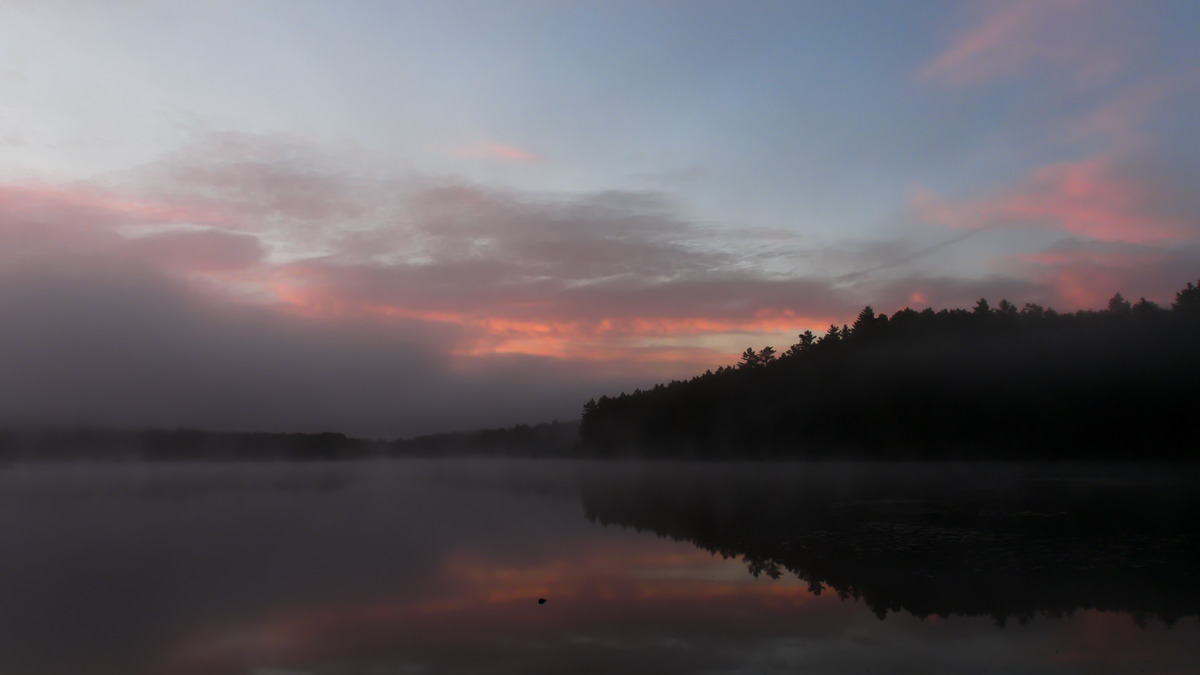
Wednesday morning was dead calm, cloudy but not solid. The sunrise was not particularly photogenic. Overnight we had a little rain and thunder, but it was calm after about midnight. The wind died as well. It was a quiet, comfortable night with no adventures.
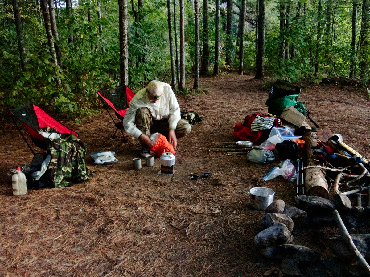
In the morning, Bob reconfigured the tarp so that we could see the lake. The sky remained overcast but with lots of definition, while the wind was relatively light from the north.
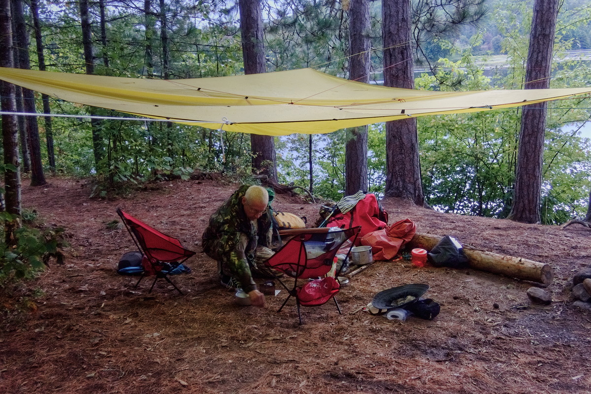
(photo by Diana: 2021-09-15 - map - explore)
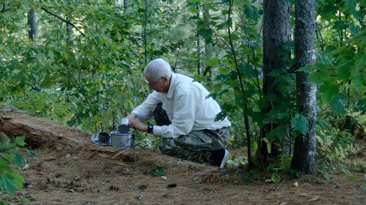
Bob getting ready to boil the kettle for morning coffee under the reconfigured tarp.

(photo by Bob: 2021-09-15 - map - explore)
Diana enjoying the results of the coffee preparation and tarp reconfiguration.

(photo by Bob: 2021-09-15 - map - explore)
A cloudy sunrise.
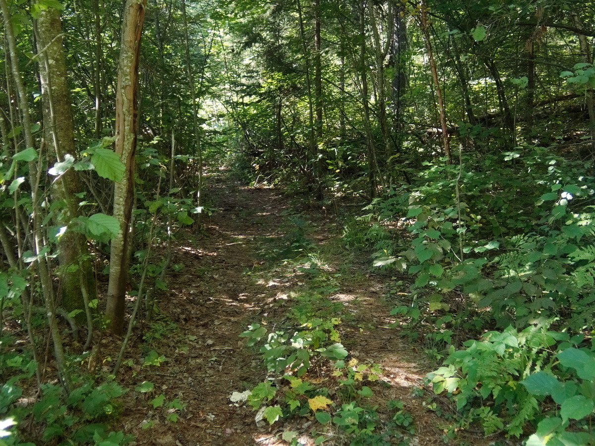
After breakfast we went to explore the trail that headed west from the adjacent campsite. (According to an old map in the Algonquin Park Archives, there used to be a ranger cabin at this campsite — or perhaps the campsite we were staying on — and that cabin was perhaps why the trail existed.) From Jeff's Map, you would get the impression that following the trail was a fairly straightforward way to reach the Spoor Lake Road, albeit, after many kilometers of walking. The reality is more complicated.
Starting at about 11:00, we followed the old road. About a kilometer in we came to a clearing –- essentially a T junction — and we turned left. After perhaps half a kilometer we came to a large poison ivy patch that completely encompassed the trail. We didn’t want to wade through it, as Diana is very sensitive to poison ivy. We retraced our steps and explored the right branch instead, which eventually led us to a clearing where we stopped for a rest and a snack. This clearing was obviously part of the horse packing operations that used to operate in this area. (We don't really know anything of the history of these horse-based operations other than we have encountered signs of the operation previously. (See A Spring Ramble Along the Spoor Lake Road). This whole area is a maze of old logging trails and staging areas that could be explored on horse back — or back-packing, for that matter.
After we got home and examined the gps location of our various photos, it is obvious that we should have pushed on beyond the clearing (or through the poison ivy patch for that matter) if our goal was to reach the Spoor Lake Road. Oh well, next time! Or perhaps we should try a day hike starting from the other end.

(photo by Bob: 2021-09-15 - map - explore)
Striding through the ferns along the trail leading from the adjacent campsite.

(photo by Bob: 2021-09-15 - map - explore)
This old steel drum was located at the T-junction that we encountered about a kilometer from the campsite.

(photo by Bob: 2021-09-15 - map - explore)
The poison ivy patch that halted our rambling to the south and eventually east. If you check this location on "Jeff's Map", it appears that if we had persevered the trail would have improved. Next time.
(photo by Bob: 2021-09-15 - map - explore)
Diana thrashing through the ferns at the "clearing". This clearing was obviously used by the previous pack-horse operations. (There was an old embedded marker on a tree.)

(photo by Diana: 2021-09-15 - map - explore)
Keeping the diary up.

(photo by Bob: 2021-09-15 - map - explore)
The clearing. There was a "horse trail marker" on the prominent white pine.

(photo by Bob: 2021-09-15 - map - explore)
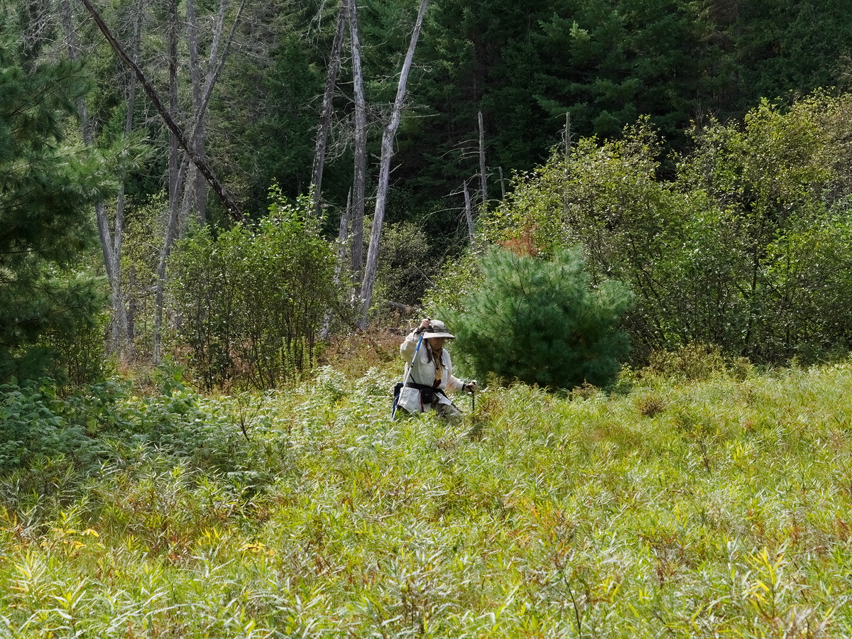
Diana having a nap back in the bush and sweet fern. While Diana was snoozing Bob continued to explore the trail to the west. It continued to be followable. However he didn't go too far — maybe a kilometer — since it was best not to get too separated.

(photo by Diana: 2021-09-15 - map - explore)
Returning to camp. This is Diana's usual view of Bob on these expeditions.
We returned to camp and built a small fire. Even this late in the season, there was lots of firewood if you were willing to walk a little down towards the other campsite. Both of us were quite tired after the morning's explorations, an unfortunate side effect of being out of shape and getting old.

(photo by Bob: 2021-09-15 - map - explore)
Diana relaxing back at the campsite.
It developed into a calm quiet evening.

(photo by Bob: 2021-09-15 - map - explore)
(photo by Bob: 2021-09-15 - map - explore)
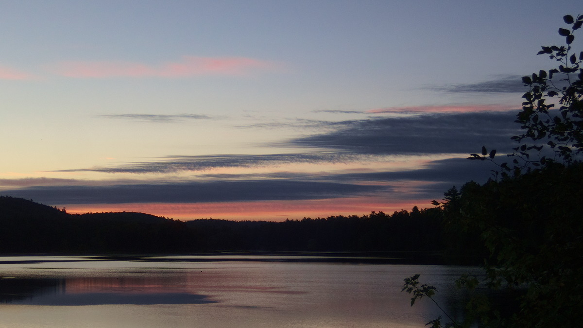
Thursday September 16
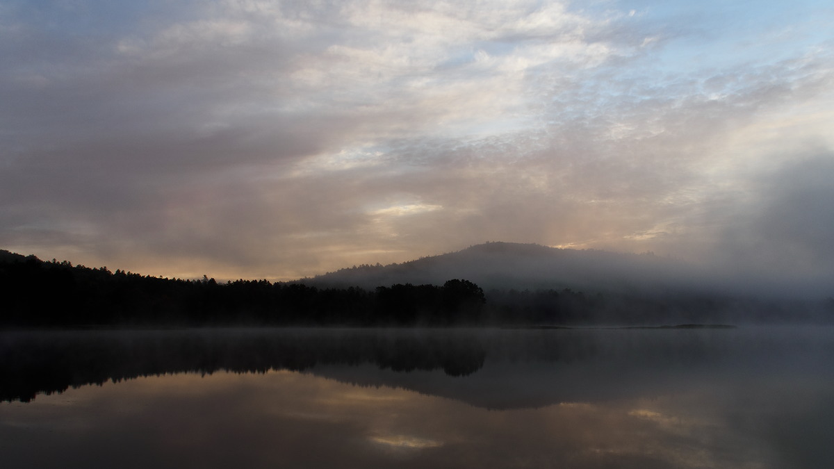
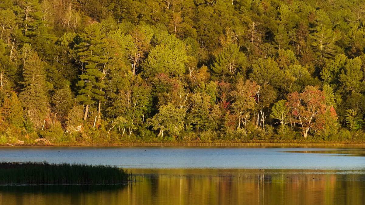
The morning was very calm with lots of mist following a quiet night with a fantastic display of stars. We got lots of good sunrise photos –- or at least we hoped they were good. The mist finally cleared by about 9:30. The morning remained chilly but pleasant in the sun.
(photo by Bob: 2021-09-16 - map - explore)

(photo by Diana: 2021-09-16 - map - explore)
(photo by Bob: 2021-09-16 - map - explore)

(photo by Bob: 2021-09-16 - map - explore)
This small flock of geese showed up in the mist after presumably flying all night. They spent the next 24 hours just drifting around and resting.
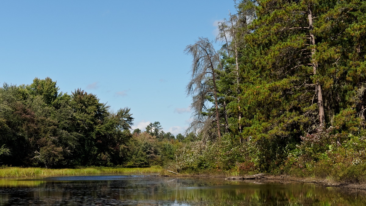
We left our campsite mid morning and paddled over to our ‘old’ campsite (the campsite we first stayed at on Whitson Lake almost 50 years ago. This campsite is not now a recognized campsite and in fact is a protected location.) Diana thought it was a possible location of the loggers camp –- maybe, but it doesn’t quite work. (The adjacent campsite to where we are staying remains the best possibility, although there are issues with that identification as well.) We then cruised along the eastern shore of the lake. Just northwest of the mouth of Louie Creek, we discovered a path heading northeast. We followed it a bit and discovered it to be an ATV trail paralleling Louie Creek. We decided to return and explore it further the next day.
In fact, we discovered the trail before we recognized the mouth of Louie Creek. We retraced our steps and then found it. But it is very nondescript at this time of year. We tried to go all the way up the lake along the eastern shore but it was too shallow — even more shallow than the last time we tried.
(photo by Diana: 2021-09-16 - map - explore)
From our campsite landing.
(photo by Diana: 2021-09-16 - map - explore)
Looking into the bay behind our campsite.
(photo by Bob: 2021-09-16 - map - explore)
Exploring the eastern shore of Whitson Lake looking for Louie Creek
(photo by Bob: 2021-09-16 - map - explore)
The eastern shore upstream of Louie Creek. It becomes very shallow and marshy the farther up (northwest) one goes.
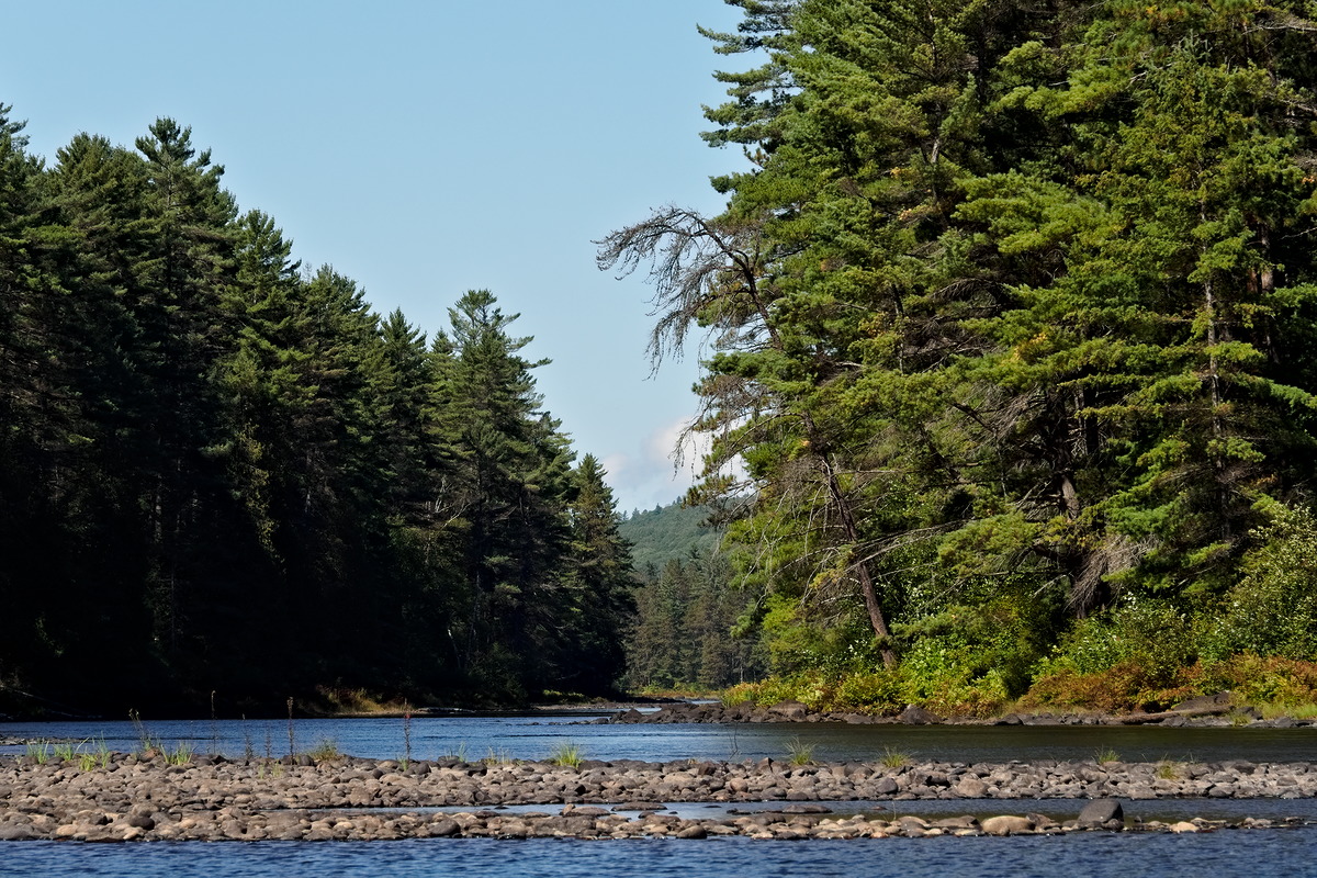
We retreated to the main channel and paddled up to the foot of Five Mile Rapids. We stopped at the campsite there for a snack. After our snack, we explored along the shore to the southeast looking for the trail that Bob, Richard, and Gregory had walked 15 years (or so) previous (A Walk to Whitson Lake). We didn’t find it per se, but Diana noted a trail that on close inspection also showed ATV tracks. But this trail was much fainter than the trail along Louie Creek. (It probably connects to that trail.)
(photo by Bob: 2021-09-16 - map - explore)
The runout of Five Mile Rapids at low water.
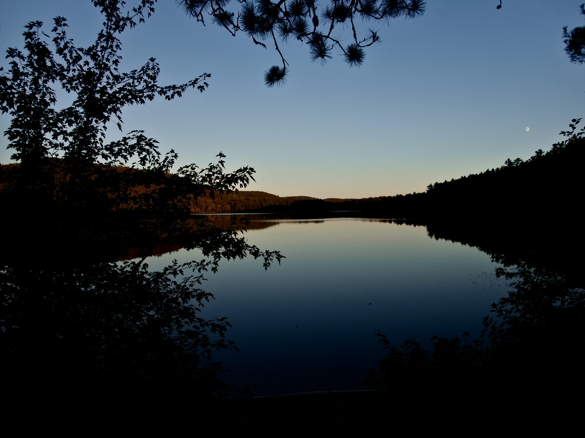
We returned to our campsite. The temperature was 22C with an occasional fresh breeze from S/SE. The sky was clear. The rest of evening proceeded without incident — Very quiet.

(photo by Diana: 2021-09-16 - map - explore)
Back at camp, waiting for something exciting to happen.
(photo by Bob: 2021-09-16 - map - explore)
Camping smile.
(photo by Bob: 2021-09-16 - map - explore)
Golden hour returns.
(photo by Diana: 2021-09-16 - map - explore)
Last of the light on a beautifully clear, calm evening.
Friday September 17
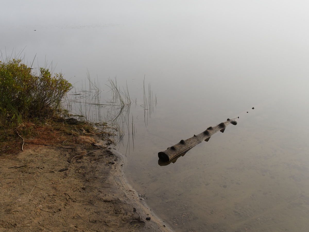
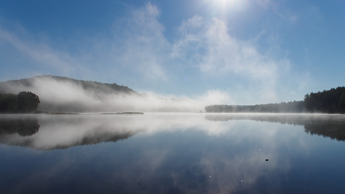
Friday morning was quiet and very misty, with a temperature of 7C. The mist precluded any sunrise photos but we were able to get lots of mist-rising photos. It warmed up quickly, reaching 16C by 9:40 under a cloudless sky.

(photo by Bob: 2021-09-17 - map - explore)
Thick mist to start the day
(photo by Bob: 2021-09-17 - map - explore)
Campsite landing – no sky reflections this morning
(photo by Bob: 2021-09-17 - map - explore)
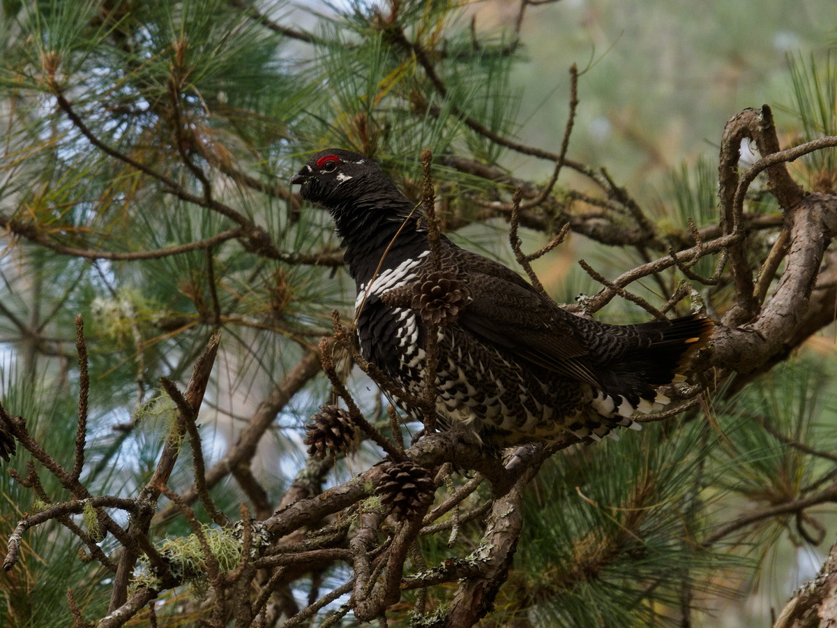
While we were having our morning coffee, we were visited by a Spruce Grouse.

(photo by Bob: 2021-09-17 - map - explore)
Yesterday's geese, still resting.
(photo by Bob: 2021-09-17 - map - explore)
Mist rising off the lake – the start of another beautiful day.

(photo by Diana: 2021-09-17 - map - explore)
Getting ready for the day's exploration
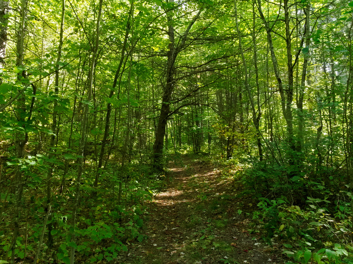
We packed up and went to explore the trail up Louie Creek. That turned out to be somewhat anticlimactic. We followed the trail for a few kilometers, had a snack break, and then returned. The farther up the trail we went, the better it got. There is no doubt that it is a rather straight forward walk to the east branch of the Wylie Bronson Rd at the park boundary.
It was quite warm, about 25C, when we returned to camp around 14:00. We had afternoon coffee and Diana had a nap.
(photo by Bob: 2021-09-17 - map - explore)
The mouth of Louie Creek.

(photo by Diana: 2021-09-17 - map - explore)
Looking towards the islands in the centre of Whitson Lake.
(photo by Diana: 2021-09-17 - map - explore)
The start of the trail up Louie Creek.

(photo by Bob: 2021-09-17 - map - explore)
Along the trail
(photo by Bob: 2021-09-17 - map - explore)
Diana tromping along the trai
(photo by Diana: 2021-09-17 - map - explore)
Eventually the trail becomes a narrow bush road
(photo by Bob: 2021-09-17 - map - explore)
A beaver meadow along the road
(photo by Bob: 2021-09-17 - map - explore)
The road improves further. It was a hot day, and we enjoyed the cool shade here.
(photo by Bob: 2021-09-17 - map - explore)
Back at Whitson Lake.
(photo by Bob: 2021-09-17 - map - explore)
At the end of the day’s hike.
(photo by Bob: 2021-09-17 - map - explore)
Back at our campsite.
(photo by Diana: 2021-09-17 - map - explore)
Washing dishes.
The evening was characterized by toads hunting bugs and a swimming moose. It was dead calm.
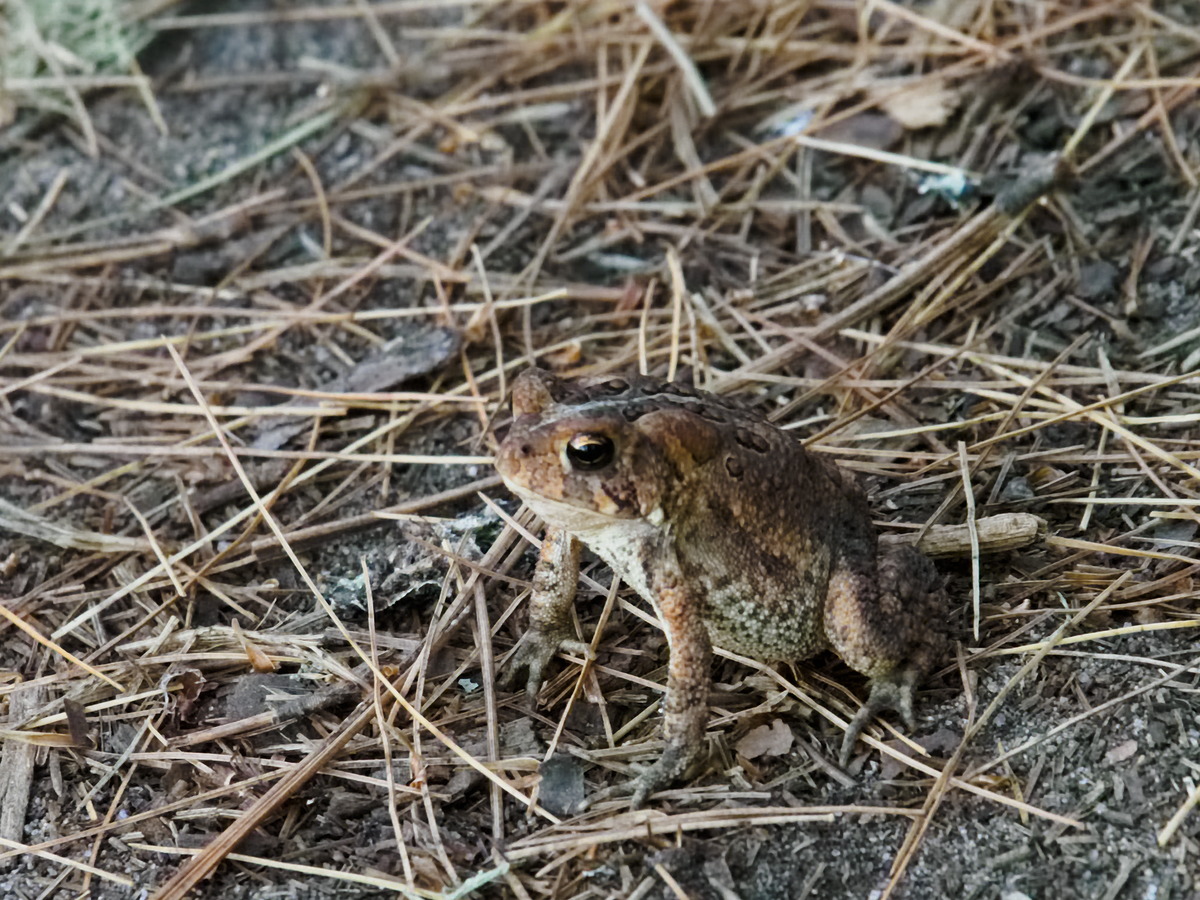
(photo by Bob: 2021-09-17 - map - explore)
In the failing light of twilight, several small toads invaded our campsite to hunt bugs. There was an ant hill near the firepit and there seemed to be a hatch of small winged ants. The toads were having a great time picking the insects off as they emerged. We were impressed by the speed at which they did it – too fast for the eye to follow.
As the evening became darker — we didn't have a fire — we could hear the heavy breathing and snorting of a moose, presumably in the vicinity of the adjacent campsite. It wasn't clear whether we were dealing with a randy bull or a randy cow or just a moose going about its normal business. We were a little concerned that it would simply follow the connecting path between the two campsites. You don't really want a moose encounter in the dark in the fall. We could also hear a lot of splashing and it soon became clear that it was swimming from the adjacent campsite, across in front of our campsite and continuing across the adjacent bay. We could follow its progress via the heavy breathing, snorting and splashing. It was too dark to get a photo — we guess it didn't want to meet us after all. The whole encounter was interesting, but also disconcerting. You tend to forget how large a moose is.
Saturday September 18
Overnight it was initially calm with no stars but the moon was bright. Later in the night it started to lightly rain. Then the rain stopped and it got windy — very windy. It was up in the treetops rather than at ground level, so it was probably out of the west. After the wind died, the stars were out and in full glory by 5:00 am. We decided to sleep some more and almost missed the sunrise. (Actually, we think we did miss the best bits.) When we got out of the tent, it was calm with no mist and some cloud — 12C.

(photo by Bob: 2021-09-18 - map - explore)
Emerging from the tent
(photo by Diana: 2021-09-18 - map - explore)
Another beautiful sunrise.
(photo by Diana: 2021-09-18 - map - explore)
Preparing the morning coffee.
We packed up and were away by about 10:30. There were a few wispy clouds and a downriver breeze. We were suspicious of the weather but nothing was imminent. We arrived back at the put-in at about 13:00. We ran both swifts and in spite of the very low water levels only had a slight touch on the swift into McManus. We had encountered two canoes on Smith Lake, the only canoes we had seen on the water during the entire trip.
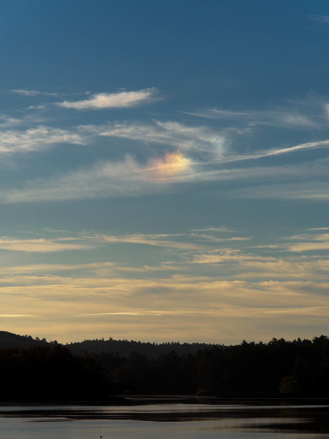
(photo by Bob: 2021-09-18 - map - explore)
Sun Dog

(photo by Diana: 2021-09-18 - map - explore)
A somewhat interesting assortment of rocks on Smith Lake.
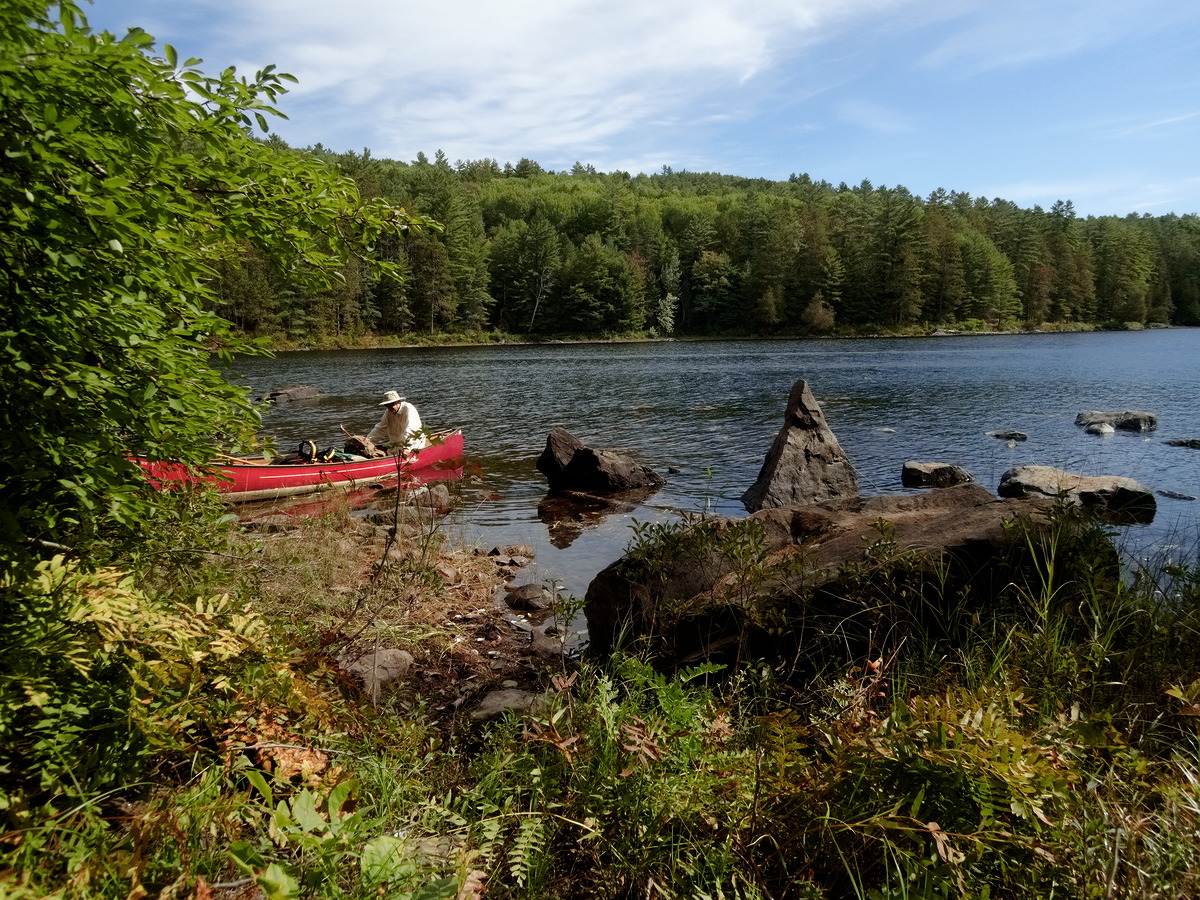
(photo by Diana: 2021-09-18 - map - explore)
Bob was somewhat less enamoured by the rocks than Diana
There were many occupied campsites on McManus (3+) but no-one at the access point. But once we reached the Barron Canyon Rd there were people all over the place. The parking lot at Squirrel Rapids was full with overflow parking on the side of the main road. People were lined up in the parking lot to enter the office at the Sand Lake gate (COVID spacing).
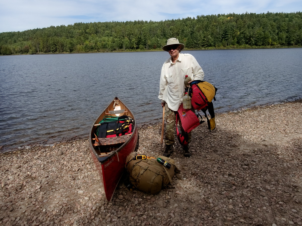
(photo by Diana: 2021-09-18 - map - explore)
Back at the access point.
The drive home was uneventful but with lots of traffic.