Unnamed Pond along Achray Road near Barron River
2018 May 23
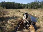
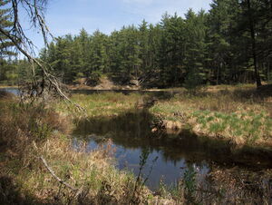
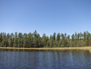
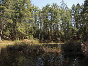
We have often noticed the small pond east of the Achray Road less than a kilometer beyond the Barron River. It seemed that it might be interesting to check it out with respect to wetland plants. But it's such a small pond that it is not worth a day trip all the way from Point Alexander. But today we were nearby and had some time.
It was an interesting little pond and we enjoyed our paddle. But it was a little too early for wetland plants. The shores of the pond were very "sedgey" but there was some sphagnum in the middle which might be interesting in a few weeks. We'll try again if circumstances permit.

(photo by Diana: 2018-05-23 - map - explore)
Outlet of unnamed pond along Achray Road near Barron River. It would probably have been easiest to have launched here and pulled up and over the beaver dam.

(photo by Diana: 2018-05-23 - map - explore)
The unnamed pond along Achray Road near Barron River as seen from the road. This is near where we bush whacked through.

(photo by Diana: 2018-05-23 - map - explore)
Launching into the unnamed pond along the Achray Road near the Barron River.

(photo by Diana: 2018-05-23 - map - explore)
The best illegal camping site on the pond. (Just kidding, don't camp here. A ranger checked out our vehicle while we were exploring the pond).

(photo by Diana: 2018-05-23 - map - explore)
Sphagnum island. There might be some interesting plants to be found here in a few weeks. At the very least, there are some pitcher plants.

(photo by Diana: 2018-05-23 - map - explore)
Mud flats with young water lilies.

(photo by Diana: 2018-05-23 - map - explore)
No matter where we go, we keep encountering pyramidal rocks. The aliens were everywhere.

(photo by Diana: 2018-05-23 - map - explore)
The northern end of the pond.

(photo by Diana: 2018-05-23 - map - explore)
A small creek enters the pond in the north east corner. This was about as far as we could comfortably get up it in our 16' prospector.

(photo by Diana: 2018-05-23 - map - explore)
Looking back towards the pond. There was no way we had room to turn around, so we turned ourselves to face the stern and paddled out backwards. (Bob makes a lousy bow paddler).

(photo by Diana: 2018-05-23 - map - explore)
Another view of the illegal campsite.

(photo by Diana: 2018-05-23 - map - explore)
The south end of the pond.

(photo by Diana: 2018-05-23 - map - explore)
At the south end of the pond.